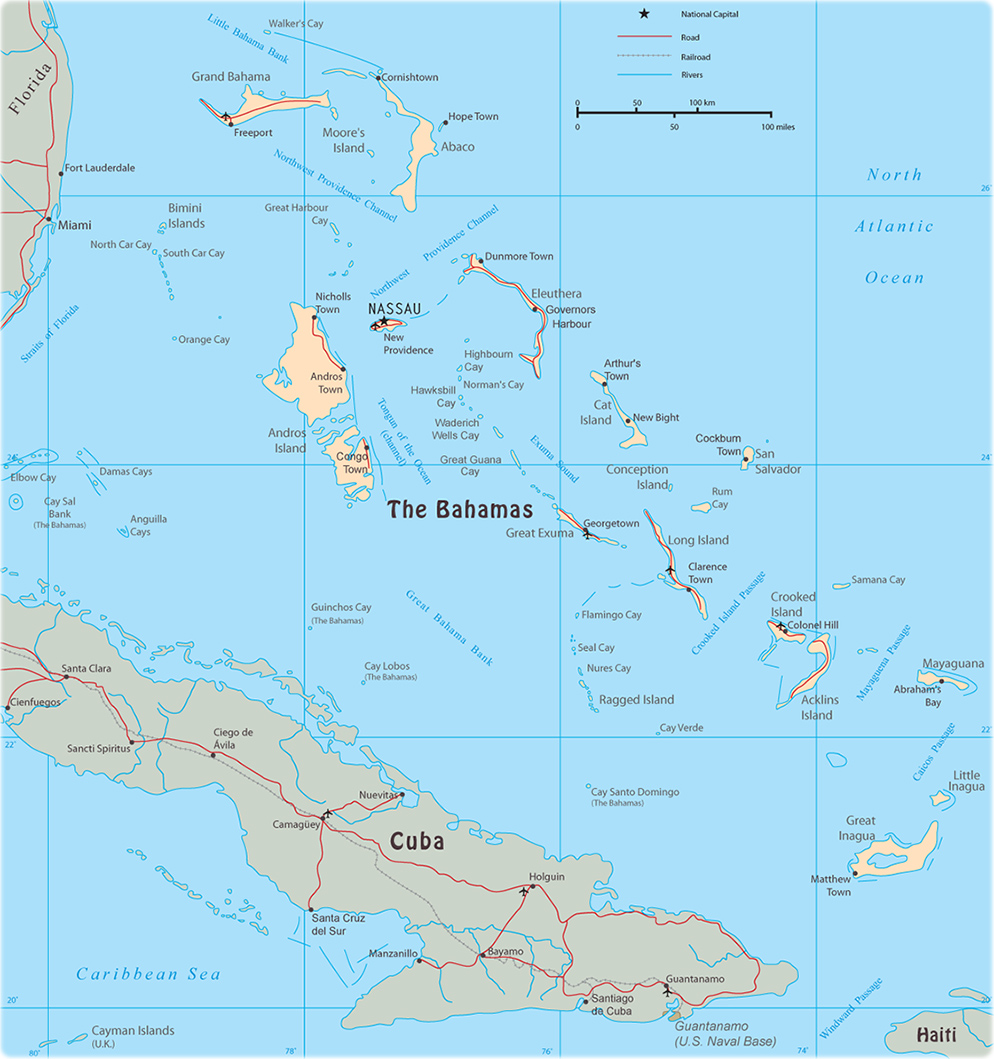
Map of The Bahamas

The Commonwealth of The Bahamas is a constitutional parliamentary democracy with 31 districts: Acklins Islands, Berry Islands, Bimini, Black Point, Cat Island, Central Abaco, Central Andros, Central Eleuthera, City of Freeport, Crooked Island and Long Cay, Exuma, Grand Cay, Harbour Island, Hope Town, Inagua, Long Island, Mangrove Cay, Mayaguana, Moore's Island, North Abaco, North Andros, North Eleuthera, Ragged Island, Rum Cay, San Salvador, South Abaco, South Andros, South Eleuthera, Spanish Wells, West Grand Bahama, East Grand Bahama.
The Bahamas is a chain of islands in the North Atlantic Ocean, southeast of Florida, northeast of Cuba. It is a coral archipelago of about 700 islands.


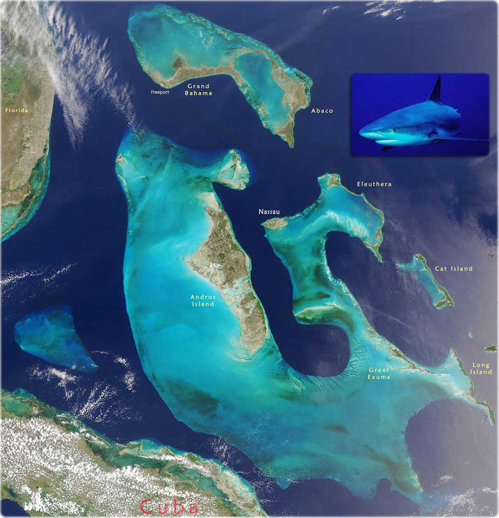
Description (from NASA, May 18, 2001): Turquoise, deep green, light blue, and bright sapphire blue colors combine in the waters surrounding the Bahamas to stand out against the deeper blue of the Atlantic Ocean. Because the 700 islands and islets sit on an underwater plateaus, the waters of the Bahamas are very shallow, ranging from barely covering the ocean floor to 25 m in depth. In image, the Great Bahama Bank is clearly visible at image center curling around the central islands, Nassau (right of Andros), Eleuthera (right of Andros), Cat Island (southeast of Eleuthera), Rum Cay (middle right edge), Long Island (south of Rum Cay), and Great Exuna (west of Long Island). In the upper part of the image, the islands of Great Abaco (left) and Grand Bahama (right) sit on the Little Bahama Bank. West of the Great Bahama Bank is the smaller, triangular Cay Sal Bank, upon which a number of small islands sit.
Caribbean reef shark, New Providence Island.
|
Copyright © Geographic Guide - Travel and Maps, American Continent. |
Map of The Bahamas