
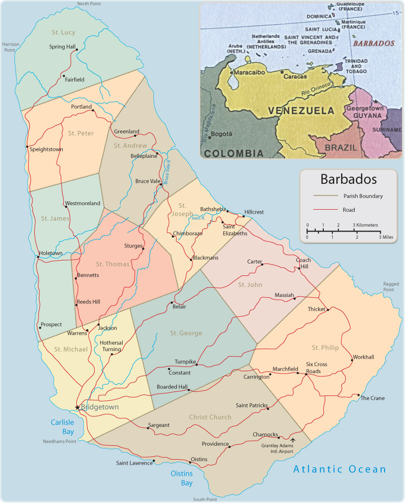
Map of Barbados
Barbados is an independent country and easternmost island of the West Indies. It lies east of Saint Vincent and the Windward Islands of the Lesser Antilles. The climate is tropical, tempered by sea breezes; the mean annual temperature is about 26°C. The natural beauty and biodiversity of Barbados attract large numbers of tourists.
|
Copyright © Geographic Guide Travel America. |