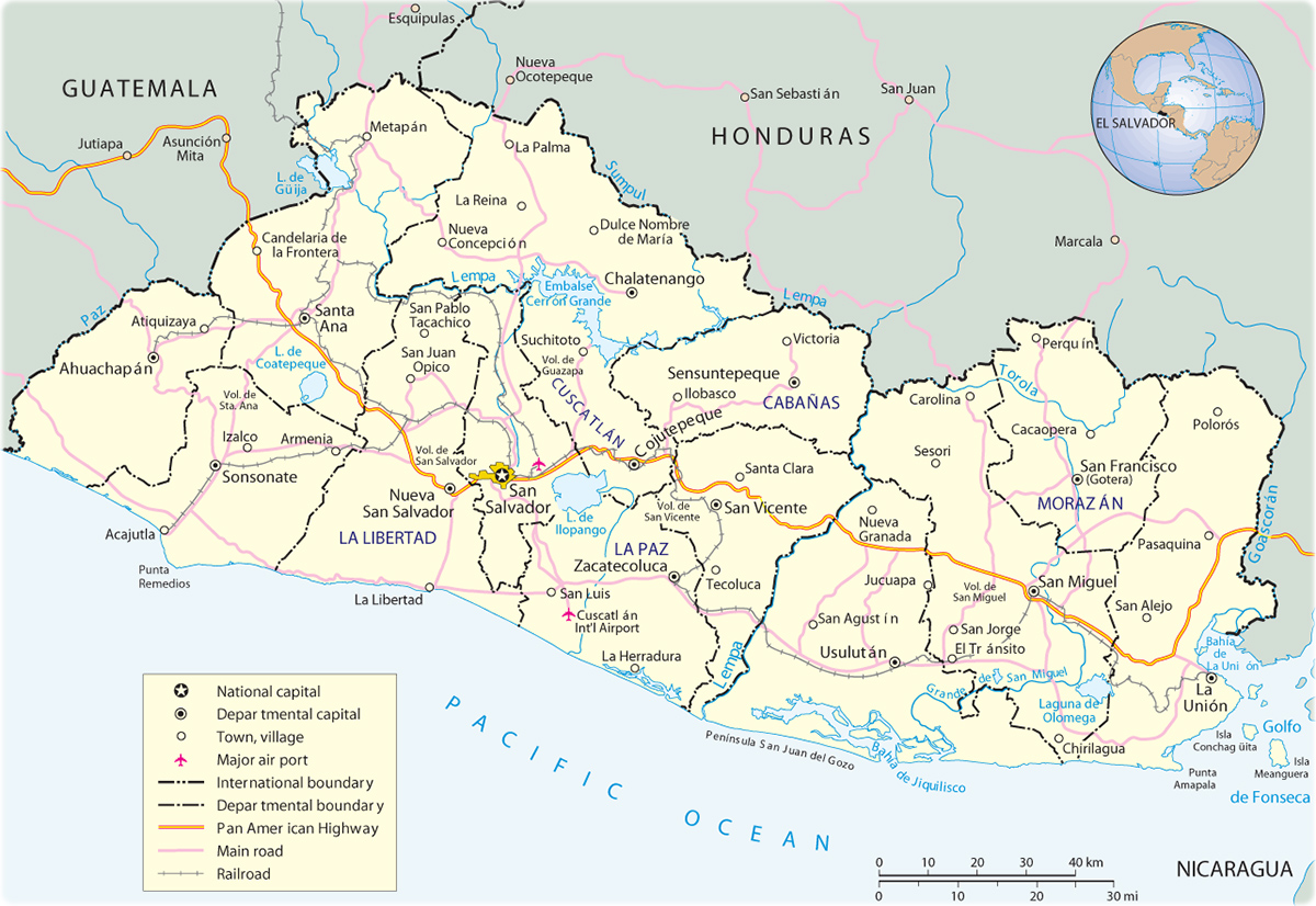
Map El Salvador
Central America
El Salvador is the smallest and most densely populated country of Central America, bordering the North Pacific Ocean, between Guatemala and Honduras. The country is divided inti departments: Ahuachapan, Cabanas, Chalatenango, Cuscatlan, San Salvador, La Libertad, La Paz, La Union, Morazan, San Miguel, San Vicente, Santa Ana, Sonsonate and Usulutan. The major seaport is Puerto Cutuco. Total coastline: 307 km. Its terrain is mostly mountains with narrow coastal belt and central plateau.
|
Copyright © Geographic Guide - Travel American Continent. |