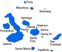
Map of Galapagos
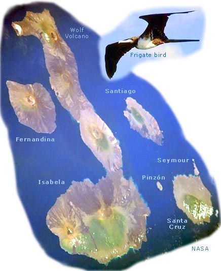
Satellite image of Galapagos
Isabela Island (seahorse-shaped) has five major volcanic peaks ranging to 1690 meters in height. Several volcanoes on the islands have been active during the 20th century. The total land area of all the islands, islets, and rocks probably does not exceed 8000 km².
Isabela Island covers 4400 km², more than half of the land area of the archipelago. Though the climate of the islands can vary, the Peru Current makes the climate mild and dry. The Galápagos Islands were discovered in 1555 and named for the gigantic land tortoises found there.
The islands—famous for their unique vegetation and wildlife—are a wildlife sanctuary. The islands were visited in 1835 by Charles Darwin who gathered data that he used later to support his theory of natural selection (source NASA).
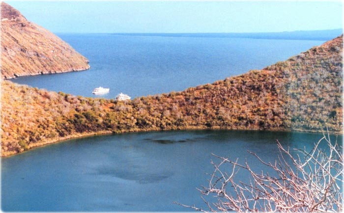
Lake Darwin, Isabela Island, Galapagos (photo: Rosalind Cohen, NOAA).
Low-oblique image - NASA.
The Galápagos archipelago is a group of 16 generally rough volcanic islands and numerous islets in the Pacific Ocean. The islands of the Galápagos rose from the ocean floor as tops of volcanoes about 10 million years ago and have never been connected to the South American mainland 1045 kilometers to the east.

Source: U.S. Central Intelligence Agency.


|
Copyright © Geographic Guide - Travel Pacific Islands. |