Political Map of Antarctica
|
Copyright © Geographic Guide - Travel the Continents. |
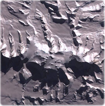
Vinson Massif is the tallest mountain in Antarctica. Its peak reaches 4,897 m, though the mountain itself is a large raised feature around 21 km long and 13 km wide, dominating the Sentinel Range of the Ellesworth Mountains in which it is located. Image courtesy of NASA.
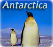
The Bouvet island is an uninhabited, volcanic island in the Southern Ocean, southwest of the Cape of Good Hope, almost entirely covered by glaciers. It is a territory of Norway. In 1971, it was designated a nature reserve. Since 1977, Norway has run an automated meteorological station and studied foraging strategies and distribution of fur seals and penguins on the island.
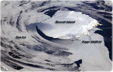
Iceberg
Source (edited): U.S. Central Intelligence Agency.
Political Map of Antarctica