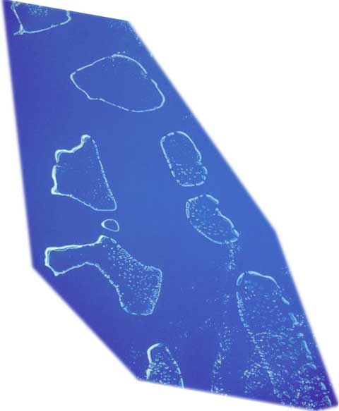
Map of Maldives


Maldives (image left) - This south-looking, low-oblique photograph shows (from north to south) the Ari, Male, Felidu, Nilande, Mulaku, and Kolumadulu Atolls of the Maldives. The 19 atolls of the Maldives are composed of more than 2000 small coral formations in the Indian Ocean southwest of India and Sri Lanka.
The chain extends north-south for approximately 880 km. The Maldives are the exposed top of a long, narrow submarine ridge whose average height is 1 to 2 meters above sea level. Most of the atolls have spacious, deep-water lagoons suitable for ship anchorage, and some have freshwater lagoons.
The Maldives have a tropical monsoonal climate, with most of the rainfall occurring from June to December. Most of the islands have poor soil and are covered by dense scrub with scattered trees, including coconut palms. Fishing and tourism are the two major industries of the country. A densely populated country, with more than 150 000 people in its total land area of 298 km², this island country is one of the 25 least-developed countries in the world, according to a United Nations report (NASA - April 1993).
Map: U.S. Central Intelligence Agency.
|
Copyright © Geographic Guide - Travel. Asian Continent. |
