|
Copyright © Geographic Guide - Travel European Continent. |
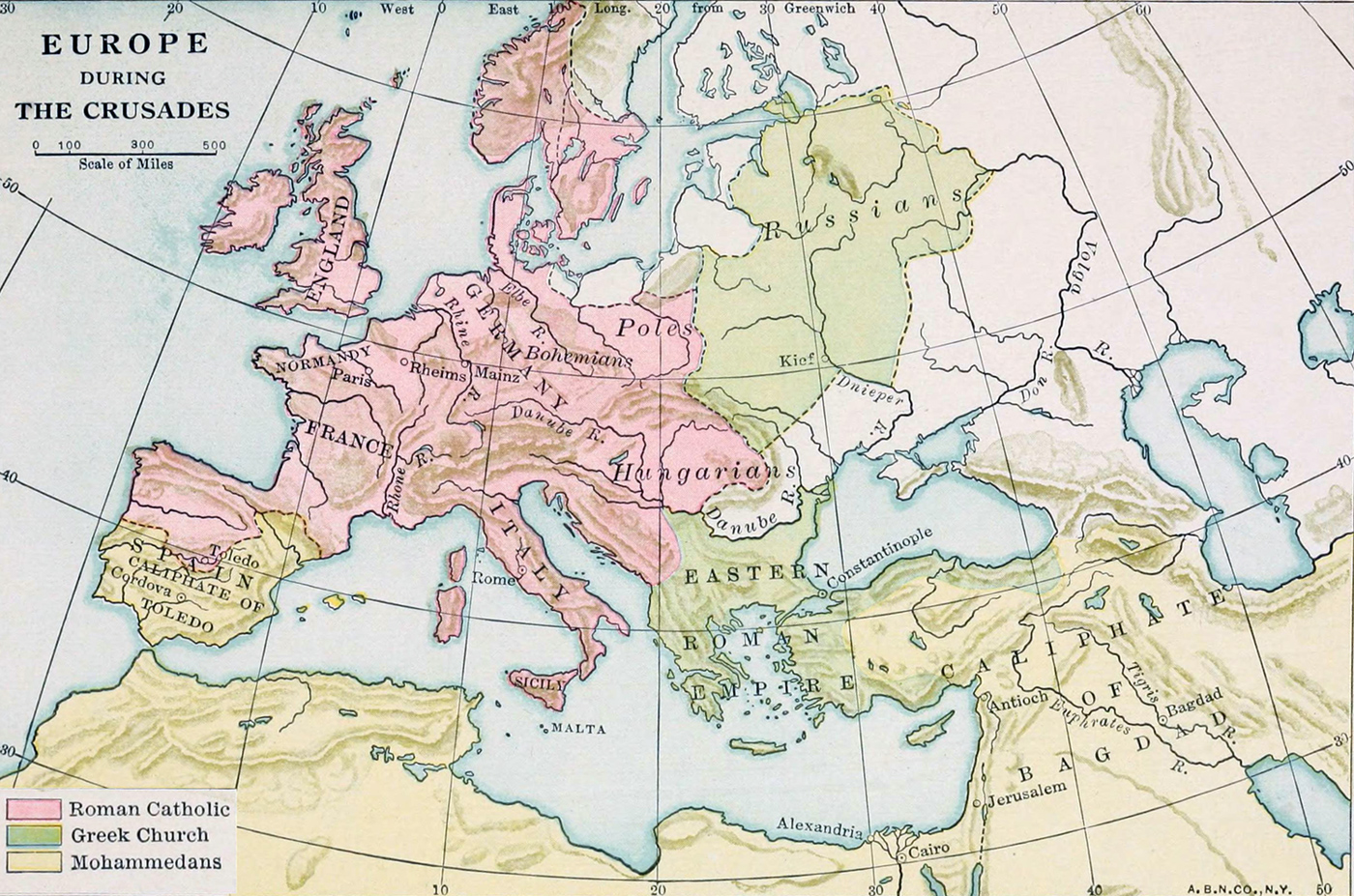
Map of Europe During The Crusades
Map published in the book An Introduction to American History - European Beginnings by Alice M. Atkinson, 1912, 1914, 1919.
Map shows the old empires, people, cities and religions of Europe and Middle East, including the Caliphate of Bagdad and Eastern Roman Empire, during the Crusades in the Middle Ages. This map illustrates Chapter X - THE CRUSADES AND RICHARD THE LION-HEARTED, The First Crusade and the Capture OF Jerusalem by the Christians. How Pope Urban II roused the people of Europe to go on a crusade to the Holy Land. The First Crusade. The Third Crusade and Richard I of England. Return of Richard. Results of the Crusades. Knighthood.
According to Atkinson, «Among the events of the Middle Ages there is none more romantic than the Crusades to the Holy Land. From the earliest times it was counted an act of piety for Christians to visit the sepulcher of their Saviour, in Jerusalem. They called Palestine the "Holy Land" because Jesus had lived and preached there. The city of Jerusalem and the country of Palestine had in time fallen into the hands of the followers of the great Arab prophet, Mohammed. The Mohammedans continued for a long while, however, to allow the Christian pilgrims to make their visits of devotion to the Holy Land unmolested. But when Palestine was conquered by a fierce tribe of Turks, the pilgrims were treated with such cruelty that the whole Christian world was thrilled with horror by it.»
«Great numbers of these pilgrims used to journey to the shrines of famous saints. They wore long cloaks and carried staffs and sacks for their bread. They often begged their way. One of the most frequented shrines was the tomb of St. Peter at Rome, and the greatest pilgrimage was the one to Jerusalem.»