Political Map of Norway
Norway is a long and mostly narrow country in northern Europe, one of the world’s northernmost countries. It occupies the western portion of the Scandinavian Peninsula. Norway’s extensive coastline is washed on three sides by seas. To the north is the Barents Sea; to the west is the Norwegian Sea; and to the south are the Skagerrak, a strait separating Norway from Denmark, and the North Sea.
Norway has several overseas possessions. In the Arctic Ocean are the Svalbard archipelago and Jan Mayen, a volcanic island northeast of Iceland. Norway’s possessions also include Bouvet Island, an uninhabited island in the South Atlantic Ocean, and Peter I Island, off Antarctica.
The beauty of the country inspired musical works by Norway’s most famous composer, Edvard Grieg, who attempted to capture the changing mood created by the alternately light and dark seasons.

|
Copyright © Geographic Guide - Travel, European Continent. |
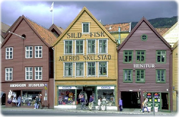
Commercial buildings in Bergen Norway.


Political Map of Norway