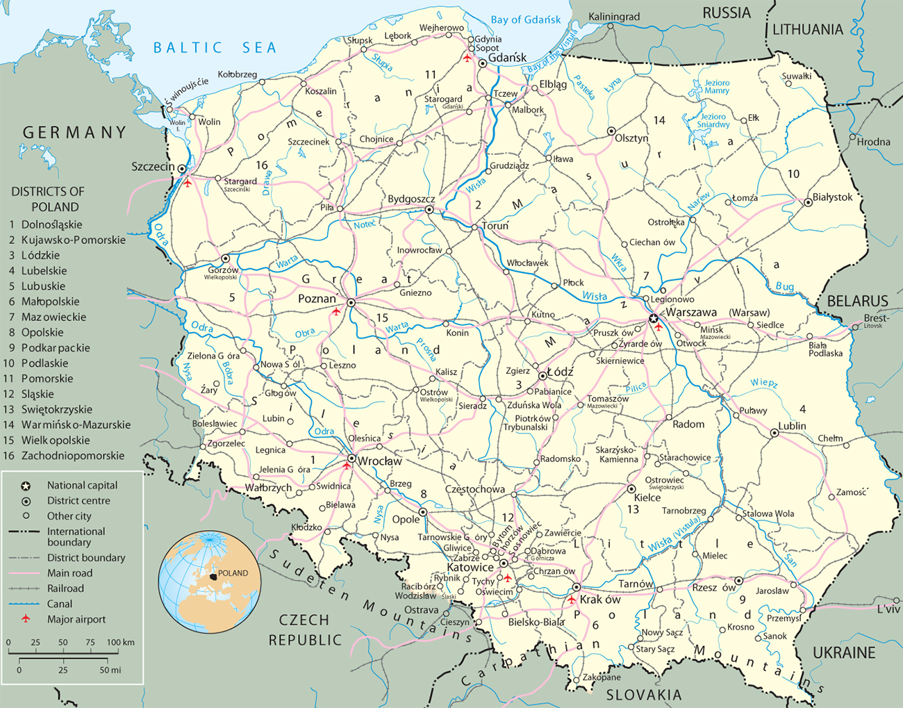
Map of Poland

|
Copyright © Geographic Guide - Travel European Continent. |
Poland has a total land area of 312,684 km². Although Poland appears as an unbroken plain on a relief map (see below), it has considerable diversity and complexity. The average elevation is only about 175 m above sea level, as compared with the overall European average of about 290 m, but elevations reach as high as 2,499 m atop Mount Rysy in the High Tatry Mountains in the south, and as low as about 2 m below sea level in the Wisła delta in the north. The northern zone is a vast region of plains and low hills, divided into the Central Polish Lowlands, the Baltic Heights, and the Coastal Plain.
The Central Lowlands are traversed from east to west by a series of large, shallow valleys. To the north of the Central Lowlands is the Baltic Heights region, dotted with hills and lakes. A few good natural harbors are located along the Baltic Sea. The southern 1/3 of Poland consists of upland areas of various kinds and adjacent or intervening lowlands. The Carpathian Mountains, located on Poland’s southeastern border, include the Tatry and Beskid ranges.
Entertainers in Krakow.

Shaded Relief Map of Poland with Provinces
Source (modified). U.S. CIA 2000.

Map of Poland