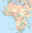
Map of the Democratic Republic of the Congo

The Democratic Republic of the Congo is a country in Central Africa, northeast of Angola. It has ten provinces: Bandundu, Bas-Congo (Lower Congo), Equateur, Kasai-Occidental (West Kasai), Kasai-Oriental (East Kasai), Katanga, Maniema, Nord-Kivu (North Kivu), Orientale, Sud-Kivu (South Kivu). The capital is Kinshasa. The major seaport is Banana.
The region was first united as the Congo Free State, a colony created by Belgian king Leopold II in the late 19th century. The colony was called the Belgian Congo from 1908 until 1960, when it gained independence as the Republic of the Congo. Its name was changed to the Democratic Republic of the Congo in 1964 and then to Zaire in 1971. It has bordes with Angola , Burundi, Rwanda, South Sudan, Uganda and Zambia.
|
Copyright © Geographic Guide - Travel, African Continent. |
◄ Africa
