Map of Libya

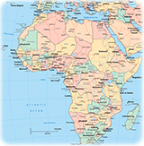
◄ Africa
The African country of Libya is divided into 22 districts: Al Butnan, Al Jabal al Akhdar, Al Jabal al Gharbi, Al Jafarah, Al Jufrah, Al Kufrah, Al Marj, Al Marqab, Al Wahat, An Nuqat al Khams, Az Zawiyah, Banghazi (Benghazi), Darnah, Ghat, Misratah, Murzuq, Nalut, Sabha, Surt, Tarabulus (Tripoli), Wadi al Hayat and Wadi ash Shati. The capital is Tripoli. Libya is bordered by the Mediterranean Sea to the north, Egypt to the east, Sudan (southeast), Chad (south), Niger (southwest), Algeria (west) and Tunisia to the northwest.
Map base: United Nations (edited).
|
Copyright © Geographic Guide - Travel, African Continent. |

Map of Libya