Satellite Image of Africa
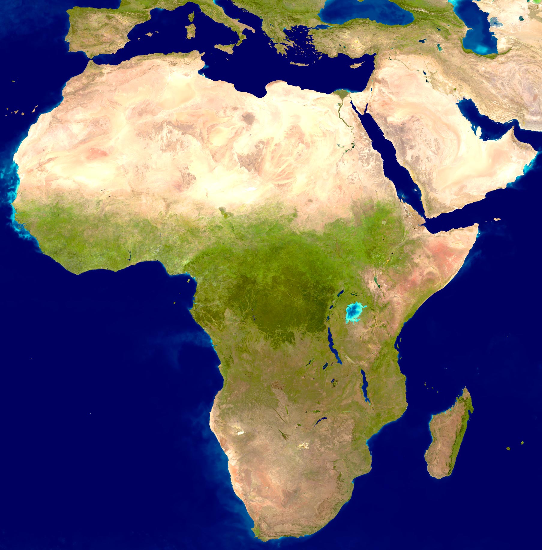
True-color image of Africa
from NASA and U.S. Geological Survey (with additional text), dated 2001
(click to enlarge) It was made using a collection of satellite-based
observations, scientists and visualizers stitched together months of
observations of the land surface, oceans, sea ice, and clouds into a seamless,
true-color mosaic of every square kilometer of our planet.
Much of the information contained in this image came from a single remote-sensing device-NASA’s Moderate Resolution Imaging Spectroradiometer (MODIS). Flying over 700 km above the Earth onboard the Terra satellite, MODIS provides an integrated tool for observing a variety of terrestrial, oceanic, and atmospheric features of the Earth. The land and coastal ocean portions of these images are based on surface observations collected from June through September 2001 and combined, or composited, every eight days to compensate for clouds that might block the sensor’s view of the surface on any single day. Two different types of ocean data were used in these images: shallow water true color data, and global ocean color (or chlorophyll) data. Topographic shading is based on the GTOPO 30 elevation dataset compiled by the U.S. Geological Survey’s EROS Data Center. MODIS observations of polar sea ice were combined with observations of Antarctica made by the National Oceanic and Atmospheric Administration’s AVHRR sensor—the Advanced Very High Resolution Radiometer. The cloud image is a composite of two days of imagery collected in visible light wavelengths and a third day of thermal infra-red imagery over the poles. More Images of Africa ►
◄ Africa

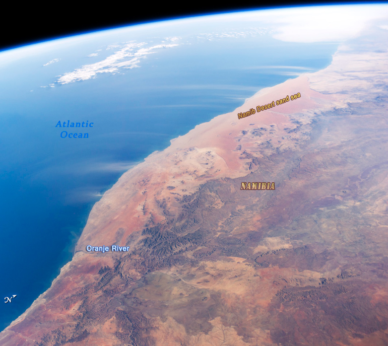
Image of the Namib coast from NASA, looking north toward the Atlantic Ocean, showing part of the Namib Desert.
Click to enlarge

Satellite Image of Africa
|
Copyright © Geographic Guide - African Continent. Maps and Geography. |