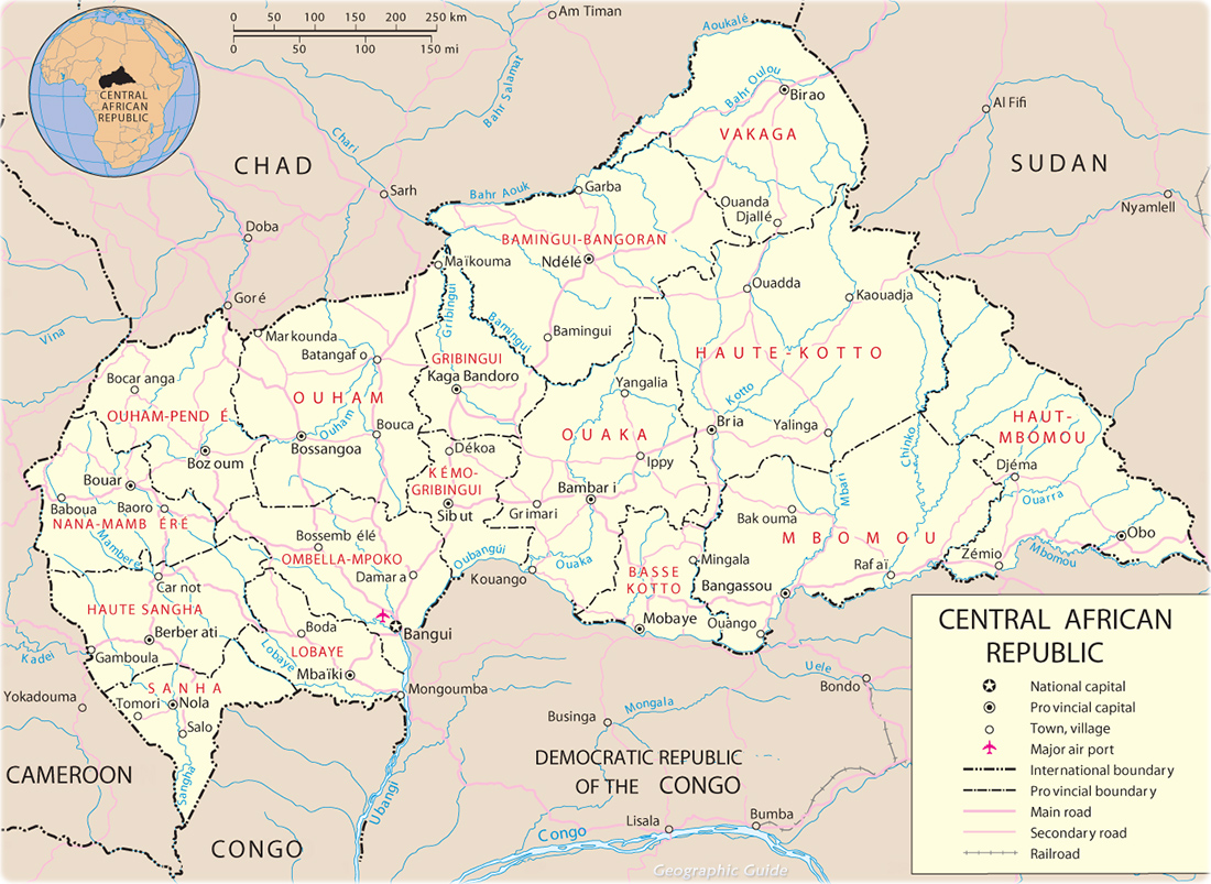
Map of Central African Republic
The Central African Republic is a country in Central Africa, bordered on the north by Chad, on the east by Sudan and South Sudan, on the south by the Democratic Republic of the Congo (formerly Zaire) and the Republic of the Congo, and on the west by Cameroon. Bangui is the capital and largest city.
Former Ubangi-Shari, Central African Empire, the country is divided into 14 prefectures, two economic prefectures (Nana-Grebizi, Sangha-Mbaere) and one commune (Bangui). Prefectures: Bamingui-Bangoran, Basse-Kotto, Haute-Kotto, Haut-Mbomou, Kemo, Lobaye, Mambere-Kadei, Mbomou, Nana-Mambere, Ombella-Mpoko, Ouaka, Ouham, Ouham-Pende and Vakaga. The highest point is Mont Ngaoui (1,420 m). River ports: Bangui (Oubangui) and Nola (Sangha).
◄ Africa

|
Copyright © Geographic Guide - Travel, African Continent. |

Map of Central African Republic