Map of Easter Island, Chile (Isla da Pascua)
One of the most isolated inhabited islands in the world, Easter Island is situated in the southern Pacific Ocean, 3540 km west of Chile. Easter Island, or Rapa Nui, as it is sometimes referred, was formed by a series of massive volcanic eruptions. Volcanic cones are found scattered across the island, including the large crater Rana Kao at the southwest end of the island and a line of cinder cones that stretch north from the central mountain, but none have been active since the island was colonized 1300 years ago. The Island is roughly triangular and covers an area of 166 km².
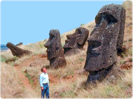
Until 1300 years ago, the island was inhabited by sea birds and was heavily forested with now extinct giant palm trees. Archaeologists believe the island was discovered and colonized by Polynesians at about 400 AD. Subsequently, a unique culture developed. The human population grew to levels that could not be sustained by the island. A civil war resulted, and the island’s deforestation and ecosystem collapse was nearly complete. Easter Island is perhaps best known for its giant statues or Moai that were carved out of volcanic rock and are scattered in various places around the island (source NASA).
Giant stone statues, called Moai, that were carved out of volcanic rock and are scattered in various places around Eastern Island.
Source: U.S. Central Intelligence Agency.


|
|
Copyright © Geographic Guide - Travel Pacific Islands. |
All rights reserved |