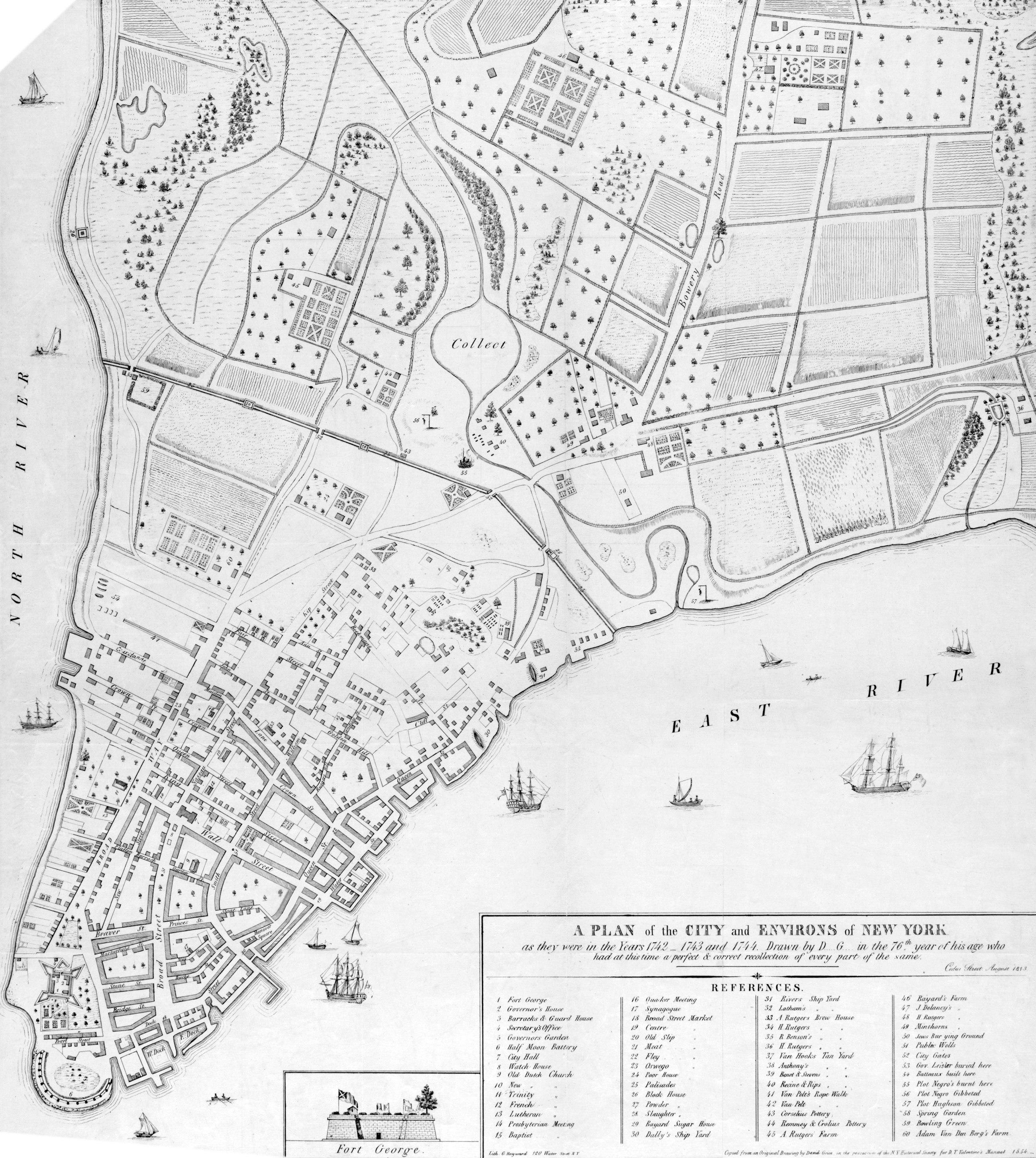
Map City of New York, 1742 / 1744 - David Grim
Original title: A Plan of the City and Environs of New York : as they were in the years 1742-1743 and 1744, drawn by D.G. [David Grim] in the 76th year of his age who had at this time a perfect & correct recollection of every part of the same. Cedar Street, August 1813. Copied from an original drawing in the possession of the N.Y. Historical Society for D.T. Valentine's manual, 1854. Lithographer George Hayward. Source: New York Public Library.
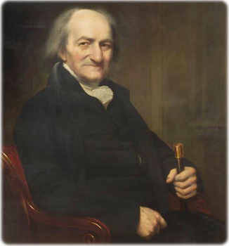
David Grim (1737-1826) was a child when he came to New York with his parents, natives of Bavaria, now part of Germany. He became a merchant and tavern keeper, later a self-taught cartographer and historian. He was the owner of the Hessian’s Coffee House, from 1767 to 1789, first on Chapel Street, and then on William Street. Grim left many maps, building sketches and notes, which were presented to the New-York Historical Society. He would have been five-years-old in 1742. He was 76 years old when he drawn the map above in August 1813. See also Part of New York in 1742.
The palisades (25), block houses (26) and city gates (52) were, in fact, erected in 1745. They were made of cedar logs, about 14 feet long and nine or ten inches in diameter. The block-houses, were about 30 feet square and 10 feet high, with six port holes, for cannons. The palisades were removed in the 1760s.

|
Copyright © Geographic Guide - 18th Century Maps, City of New York. |
David Grim in 1812. Oil on canvas by Samuel Lovett Waldo (1783–1861). Source: New-York Historical Society.


Map City of New York, 1742 / 1744 - David Grim