
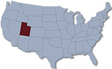
Map of Utah
Utah is a landlocked state in the western region of the USA, partly in the Rocky Mountains. Most of eastern and southern rivers in Utah drains into the Colorado River system and eventually to the Gulf of California. The capital and largest city is Salt Lake City. It is bordered by the states of Colorado, Wyoming, Idaho, Arizona, Nevada and touches a corner of New Mexico in the southeast.
Political Map of Utah
◄ Utah
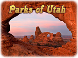
Rock formation in the Arches National Park, Utah.


Monument Valley

|
Copyright © Geographic Guide - Travel, North America. |
Source (edited): USGS National Map.