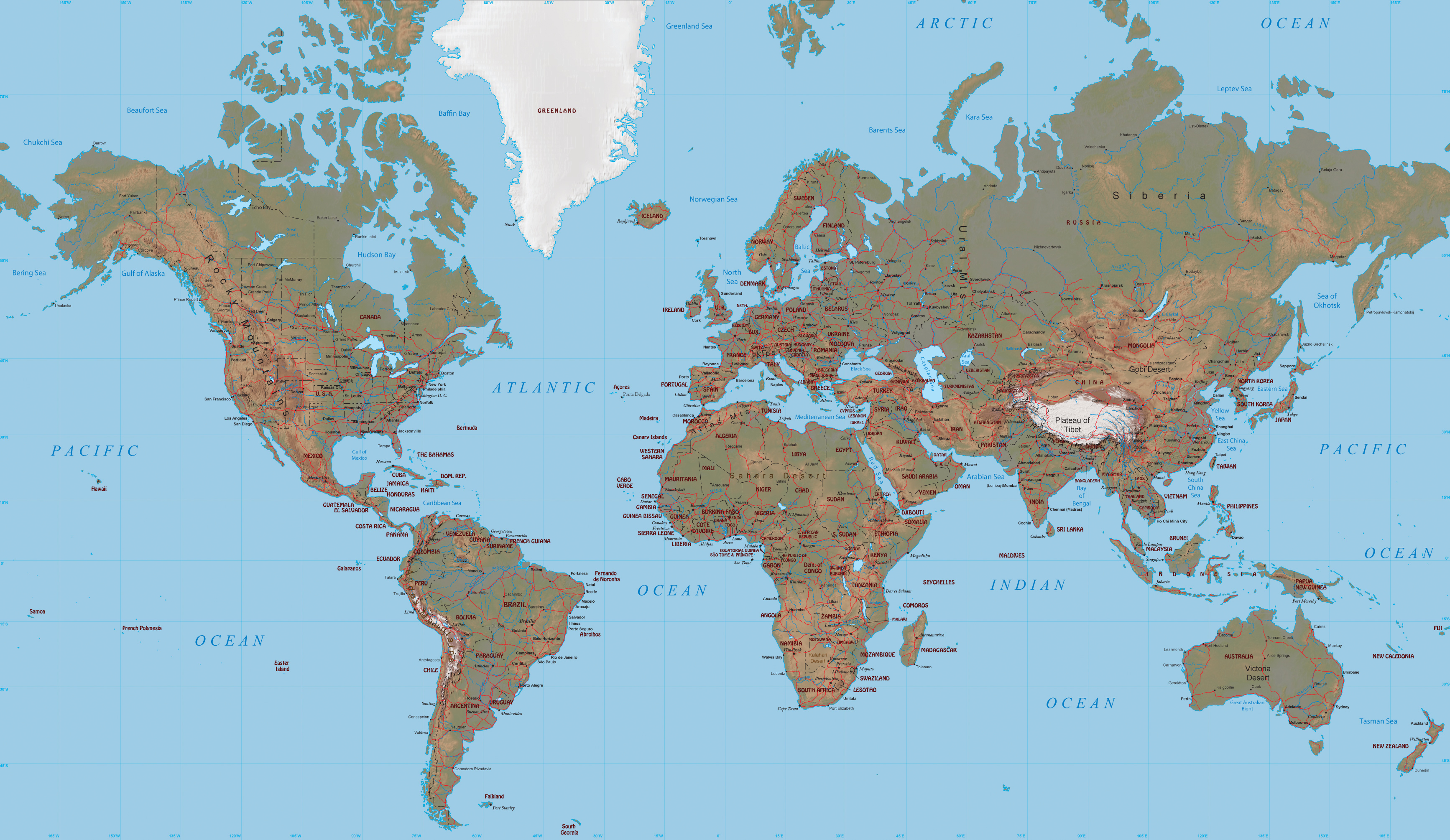
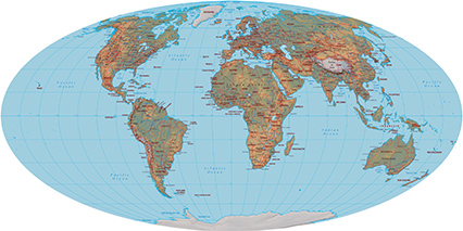
World Map - Mercator Projection
The Mercator projection is a cylindrical map projection developed by Flemish cosmographer Gerardus Mercator in 1569. It became the standard map projection for ocean navigation. In this projection, landmasses such as Greenland, Antarctica, Canada and Russia appear far larger than they really are relative to landmasses near the equator, such as Central Africa and Antilles.
Top ten longest mountain ranges (land-based): Andes (Venezuela, Colombia, Ecuador, Peru, Bolivia, Chile, Argentina) 7,000 km; Rocky Mountains (Canada, US) 4,830 km; Great Dividing Range (Australia) 3,700 km; Transantarctic Mountains (Antarctica) 3,500 km; Kunlun Mountains (China) 3,000 km; Ural Mountains (Russia, Kazakhstan) 2,640 km; Atlas Mountains (Morocco, Algeria, Tunisia) 2,500 km; Appalachian Mountains (Canada, US) 2,400 km; Himalayas (Pakistan, Afghanistan, India, China, Nepal, Bhutan) 2,300 km; Altai Mountains (Kazakhstan, Russia, Mongolia) 2,000 km; note - lengths are approximate; if oceans are included, the Mid-Ocean Ridge is by far the longest mountain range at 40,389 km (source: World Factbook).
|
Copyright © Geographic Guide - Travel Planet Earth. |
World Map - Mercator Projection