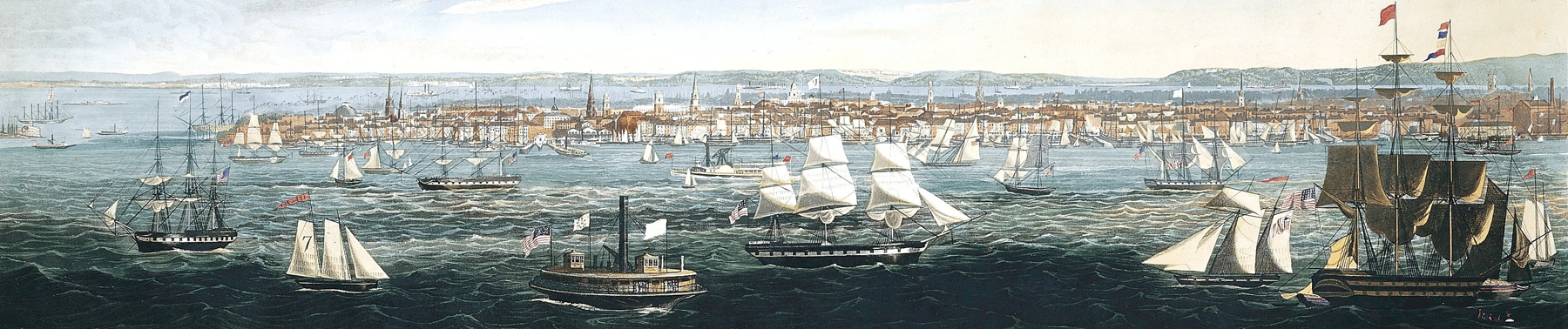
Panoramic View of New York, taken from the East River - 1844
Skyline of Southern Manhattan by 1844. Painted and engraved by British artist Robert Havell, the vessels drawn by J. Pringle. Published by Robert Havell and William A. Colman. This illustration was issued in 1844 as a companion piece to "Panoramic View of New York Taken from the North River". The East River is busy with sail and steamship traffic.
Piers, wharves and docks ringed southern Manhattan. In the 1840s, New York handled about 60% of the imports of the United States and 30.5% of exports.
Source: Metropolitan Museum of Art. Below, enlargements of another color version from the New York Public Library.
More: Historical maps of New York ►
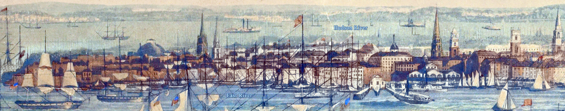
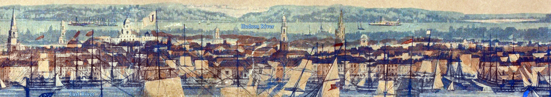
Above, enlargement of the southern tip of Manhattan, with additional texts. Version of the New York Public Library. Below, enlargement of the central part of the illustration.
|
Copyright © Geographic Guide - 19th Century NYC. |


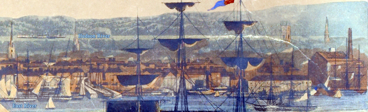

Enlargement of the part on the right.
Panoramic View of New York, taken from the East River - 1844