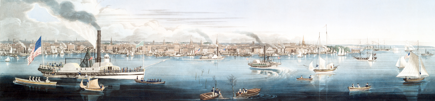
Panoramic view of New York, taken from the North River - 1840
Aquatint drawn, engraved and published by Robert Havell (1793-1878), vessels painted by James Fulton Pringle (1788-1847). Copyright 1840. Source: New York Public Library. Enlargements below.
The print contains references in the lower margin to Clinton Market, Washington Market, Shad Fishing, Battery and British Queen (the first transatlantic steamboat). The Hudson (North) River is busy with river traffic. Robert Havell arrived in the United States in 1839.
New York was a busy port, dominated by steamboats.
More: Historical maps of New York ►
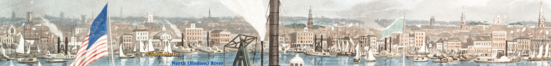
Enlargement of buildings in the part on the left, with additional texts.
|
Copyright © Geographic Guide - 19th Century NYC. |


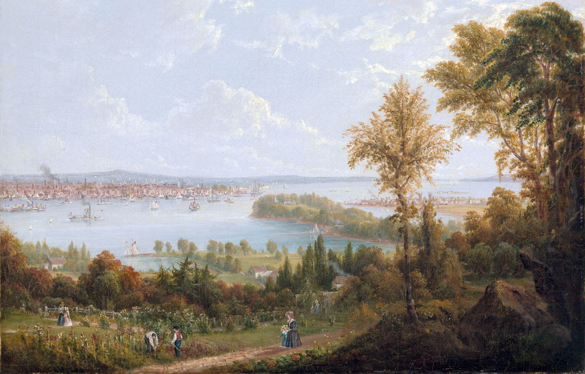


View of the Bay and City of New York from Weehawken (New Jersey), 1840. Oil on canvas by Robert Havell Jr., the same artist and the same year of the illustration above. Source: Metropolitan Museum of Art.
The City of New York had become the busiest port on the East coast of the United States due to increased access to interior trade routes up the Hudson River via the Erie Canal, opened in 1825.
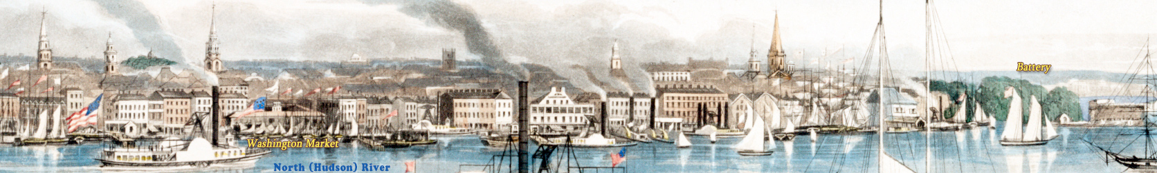
Enlargement of the skyline on the right, with additional texts.
Panoramic view of New York, taken from the North River - 1840