Images of North America from Space
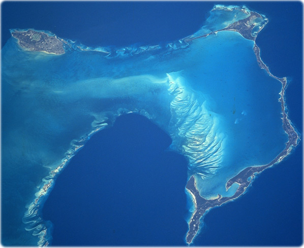
Bahamas (right) - New Providence Island (left center), where the capital city of the Bahamas, Nassau is located, is 34 km long and 11 km wide and covers an area of 207 km². Nassau is the commercial and social center of the Bahamas. The city has a large and beautiful harbor. Nassau has a warm, healthful climate, and a colorful atmosphere that makes the city a favorite winter resort. Eleuthera Island (right half) is 133 km long and 3 km wide. The island is generally flat and has no rivers. There are many mangrove swamps, brackish lakes, coral reefs and shoals, and miles of fine sandy beaches.
Eleuthera, which means "freedom" in Greek, was one of the first of the Bahama Islands to be colonized. The darker blue water of the Northeast Providence Channel (this is part of the Grand Bahama Submarine Canyon) is visible across the top portion of the image. The extreme southern portion of the Berry Islands, are discernible in the upper-left portion of the image. Covering the lower center portion of the image are the dark blue waters of Exuma Sound (NASA).

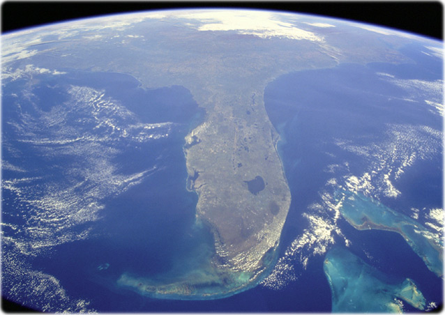
Florida Peninsula (NASA).
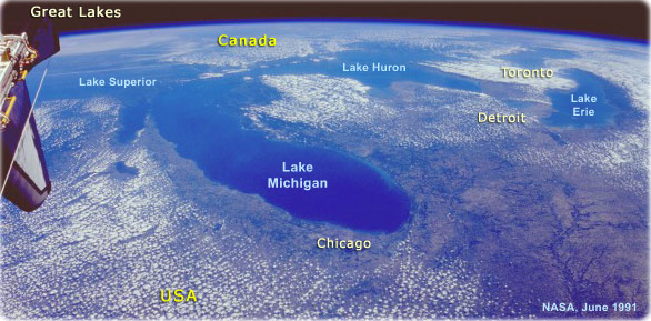
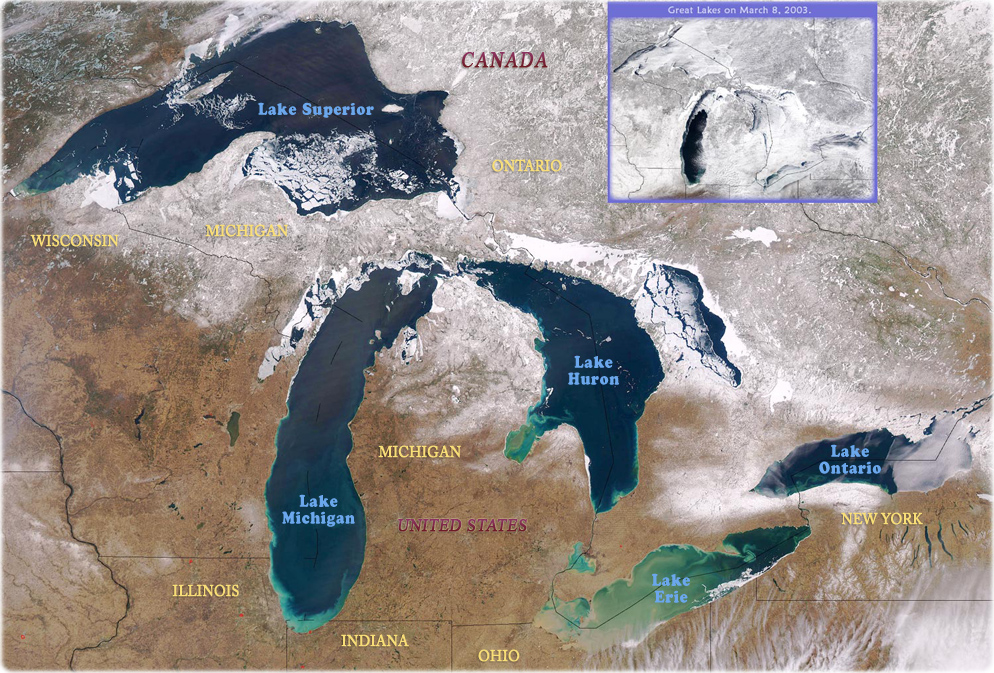
The Great Lakes, U.S.A. and Canada (NASA - June 1991, image above). Portions of all five Great Lakes, the largest combined body of fresh water in the world, covering an area of 246 050 km², can be seen in this high-oblique, northeast-looking photograph. Lake Michigan alone covers an area of 57 755 km². This lake can be seen in the center of the photograph, with Chicago on its southwestern shore. The Great Lakes were formed about 12 000 years ago at the end of the ice age, when glacier-carved lake basins were filled with meltwater. The lakes are interconnected by straits, short rivers, and canals. Water from the Great Lakes exits at the eastern end of Lake Ontario into the Saint Lawrence River, which flows on eastward into the Atlantic Ocean.
Image from the Aqua satellite on April 10, 2003, shows ice still clinging to shorelines in (west to east) lakes Superior, Michigan, Huron, Erie, and Ontario. South of Lake Ontario in New York, slivers of dark blue water are the glacier-carved Finger Lakes (NASA, edited).
|
Copyright © Geographic Guide - Travel North America. Images of the Planet Earth. |


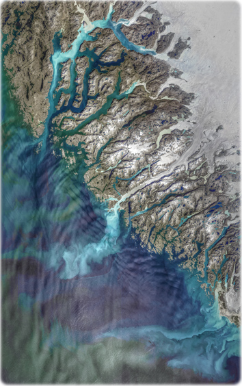
View of southwestern Greenland, collected on August 29, 2019 (NASA). It shows meltwater loaded with glacial sediments flowing into the Davis Strait.


The Bahamas
Florida Keys
Gulf of Mexico
Miami
Florida
Images of North America from Space