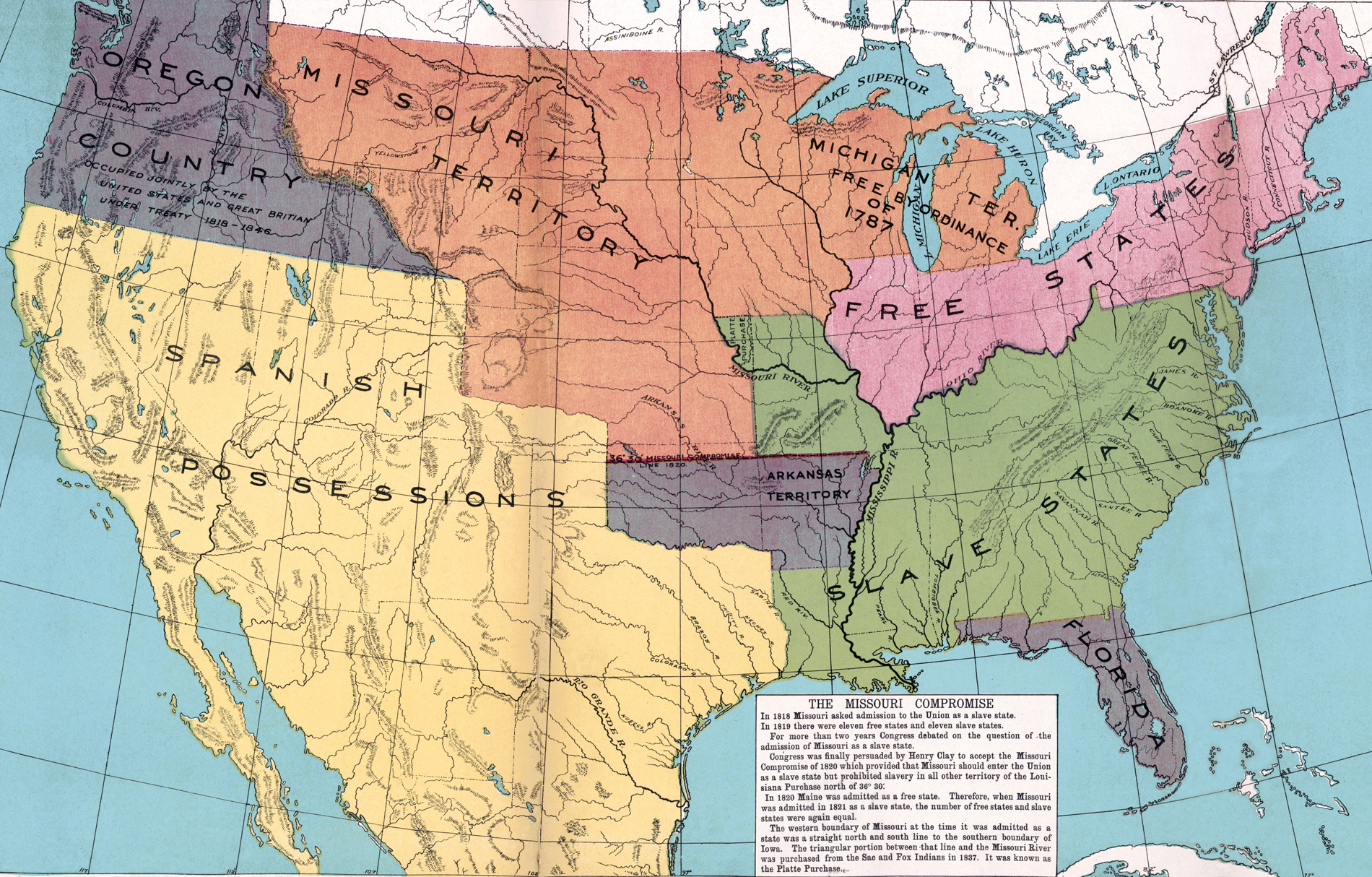
US Map in 1820, Missouri Compromise, Free and Slave States
Historical map of the United States of America in 1820, showing Free States, Slave States the Missouri Compromise, Oregon Country, Arkansas, Missouri, Florida and Michigan territories, and Spanish possessions. Source: McConnell's Historical Maps of the United States, 1919.
Text that accompanies this map: In 1818 Missouri asked admission to the Union as a slave state. In 1819 there were eleven free states and eleven slave states. For more than two years Congress debated on the question of the admission of Missouri as a slave state. Congress was finally persuaded by Henry Clay to accept the Missouri Compromise of 1820 which provided that Missouri should enter the Union as a slave state but prohibited slavery in all other territory of the Louisiana Purchase north of 36° 30'. In 1820 Maine was admitted as a free state. Therefore, when Missouri was admitted in 1821 as a slave state, the number of free states and slave states were again equal. The western boundary of Missouri at the time it was admitted as a state was a straight north and south line to the southern boundary of Iowa. The triangular portion between that line and the Missouri River was purchased from the Sac and Fox Indians in 1837. It was known as the Platte Purchase.
In 1857, the Supreme Court ruled that the Missouri Compromise was unconstitutional and ruled that Congress did not have the authority to prohibit slavery in the territories. The sectional conflict over the extension of slavery in the United States led to the Civil War.
Oregon Country was a large region of the Pacific Northwest of North America that was subject to a long dispute between the United Kingdom and the United States in the 19th century. In 1848, the U.S. portion of the Oregon Country was formally organized as the Oregon Territory.

|
Copyright © Geographic Guide - 18th Century, American Continent. Historical Maps USA. |


US Map in 1820, Missouri Compromise, Free and Slave States