Map of North America - 18th Century
North and Central America in 1750 by Bormay & Co., N.Y., showing claims arising out of explorations. Map published in A History of the American People by Woodrow Wilson, 1902. Woodrow Wilson was the the president of Princeton University and in March 1913, he became the 28th President of the United States of America.
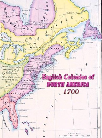
At the time, three countries contended for dominion of North America: Great Britain, France and Spain. The map shows political divisions in the 18th century: British colonies, New France, Louisiana, New Spain, Hudson's Bay Company, Florida, Cuba, Jamaica, Bahamas and the unexplored lands on the west and north of the continent. The Hudson’s Bay Company was incorporated in England, in 1670, to seek a northwest passage to the Pacific Ocean, to occupy the lands adjacent to Hudson Bay, and to carry on any profitable commerce with those lands. After the Independence War (1775-1783), the political division of North America was drastically changed.
More: Historical maps of United States ►
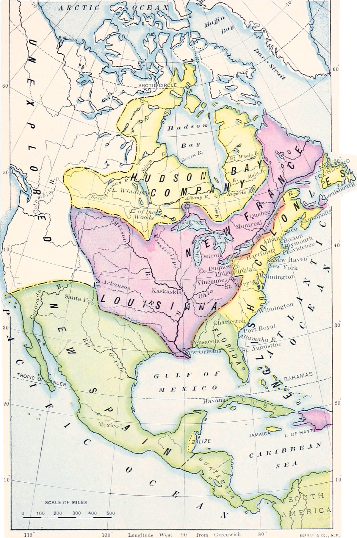
Map of North America - 18th Century
|
Copyright © Geographic Guide - Historical Geography, American Continent. 18th Century |