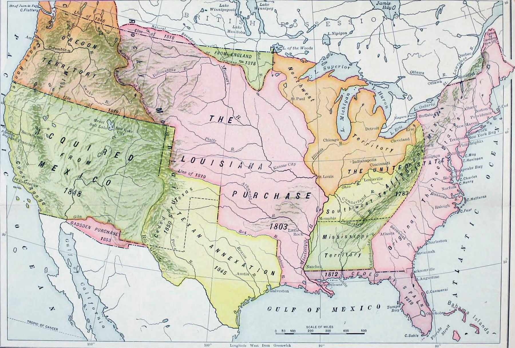
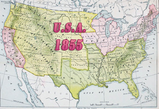
United States of America, Territorial Acquisitions, 1783-1853
Historical map of the United States of America, showing territorial acquisitions from 1783 to 1853, published in A History of the American People by Woodrow Wilson (1902), then the president of Princeton University and in March 1913, he became the 28th President of the United States of America.
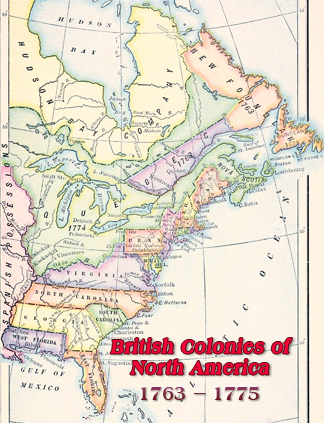
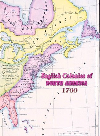
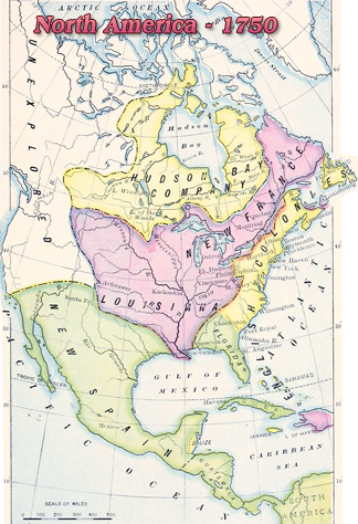
In 1775, thirteen British colonies on the Atlantic coast of North America started a war of independence against Great Britain. These 13 colonies were: New Hampshire, Massachusetts, Rhode Island, Connecticut, New York, New Jersey, Pennsylvania, Delaware, Maryland, Virginia, North Carolina, South Carolina and Georgia. Independence came in 1783 and the United States of America were formed by the original 13 states. Territorial acquisitions began with the Southwest Territory.

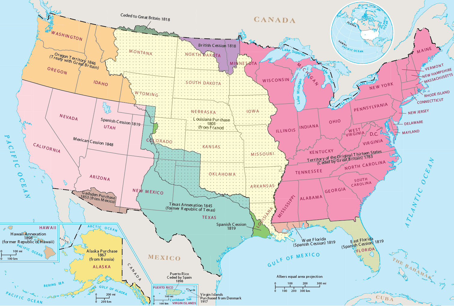
Map of the territorial acquisitions from the National Atlas of the United States of America (2005) by the U.S. Geological Survey.
|
Copyright © Geographic Guide - Historical Geography, American Continent. Historical Maps. |
United States of America, Territorial Acquisitions, 1783-1853