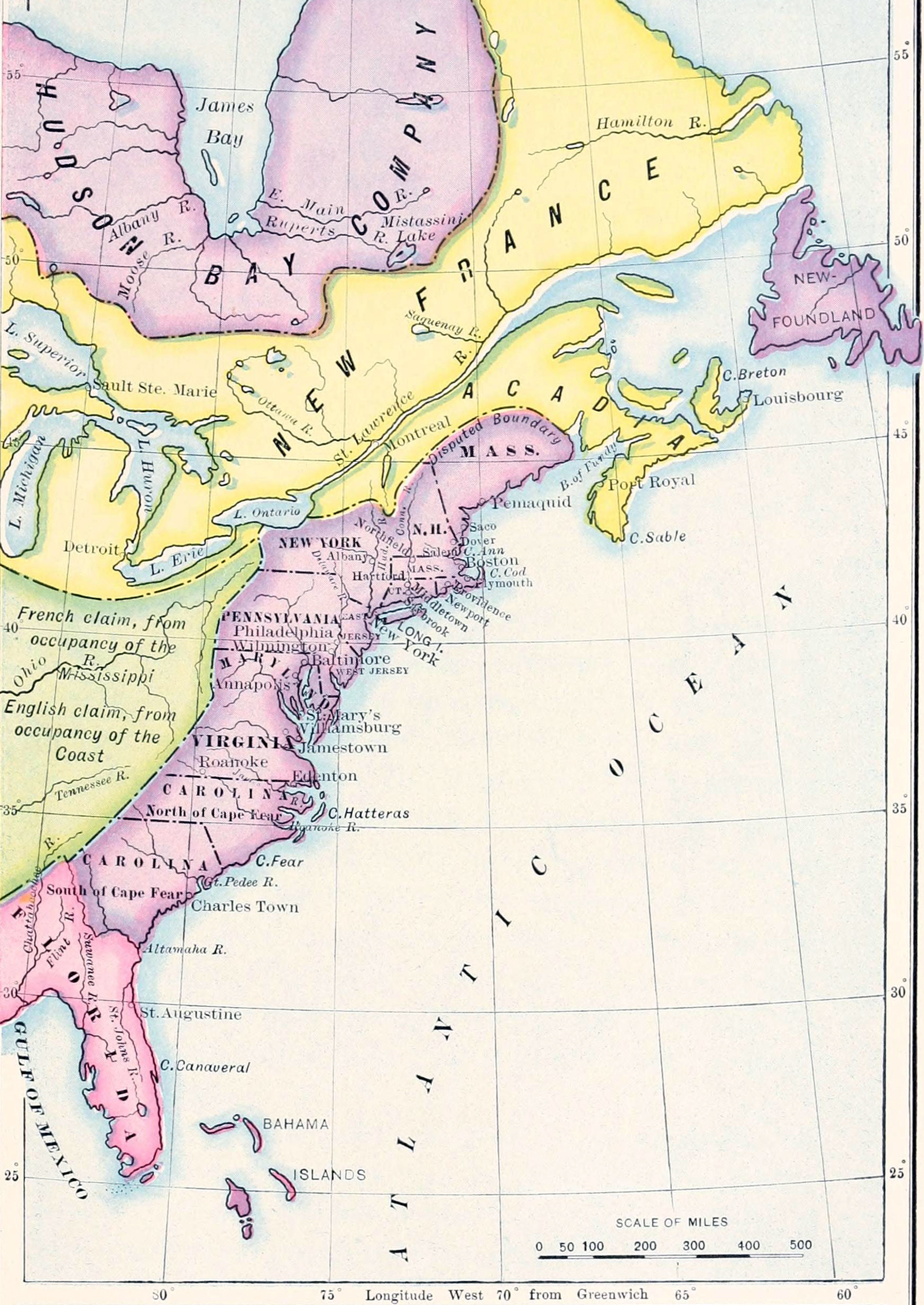
![]() Original title: English Colonies, 1700. Map published in A History of the American People by
Woodrow Wilson (1902), then president of Princeton
University and in March 1913, he became the 28th President of the United States
of America.
Original title: English Colonies, 1700. Map published in A History of the American People by
Woodrow Wilson (1902), then president of Princeton
University and in March 1913, he became the 28th President of the United States
of America.
This was the last year of the 17th century, the colonizers of most of the east coast of North America were the English. After the Act of Union of May 1, 1707, that effected the union of England and Scotland, under the name of Great Britain, these colonies became "British".
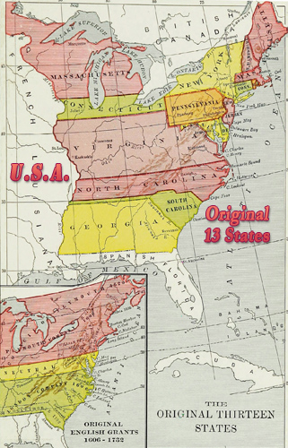
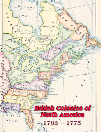
The Hudson’s Bay Company was incorporated in England, in 1670, to seek a northwest passage to the Pacific Ocean, to occupy the lands adjacent to Hudson Bay, and to carry on commerce with those lands. In 1702, East and West Jersey were combined to form the Province of New Jersey. Florida was then a Spanish colony, transferred to Britain in 1763 and split into West and East Florida, both territories of Britain.
Text from the Woodrow Wilson's book: «King William's War (1689-1697), with its eight years of conscious peril, set new thoughts astir. It made America part of the stage upon which the great European conflict between French and English was to be fought out ; and immediately a sort of continental air began to blow through colonial affairs. Colonial interests began to seem less local, more like interests held in common, and the colonies began to think of themselves as part of an empire.»
More: Historical maps of United States ►