Original 13 States - 18th Century
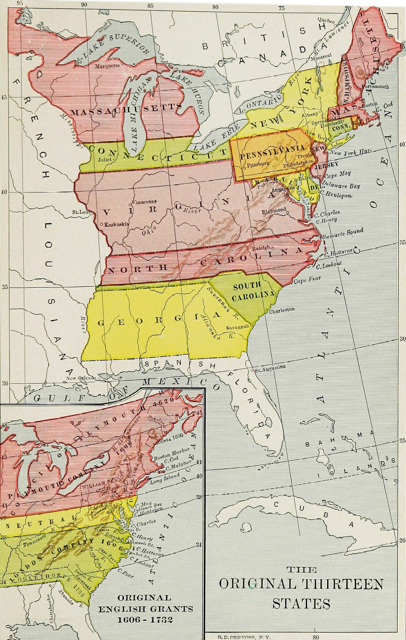
Historical map of the United States of America, showing the original thirteen states in the 18th century. On the bottom left, the original English grants from 1606 to 1732, including the London Company and the Plymouth Company. Map published in Harper's Encyclopædia of United States History from 458 A.D. to 1906, based upon the plan of Benson John Lossing (1907).
In 1775, the Continental Congress hosted a convention of delegates for the Thirteen Colonies. It raised an army to fight the British and named George Washington its commander, made treaties, declared independence, and recommended that the colonies write constitutions and become states, later enumerated in the 1777 Articles of Confederation. The states ratified the Articles of Confederation from 1777, beginning with Virginia, to 1781, with Maryland. The 13 original states were: New Hampshire, Massachusetts, Rhode Island, Connecticut, New York, New Jersey, Pennsylvania, Delaware, Maryland, Virginia, North Carolina, South Carolina and Georgia.


|
Copyright © Geographic Guide - 18th Century, American Continent. Historical Maps USA. |
Original 13 States - 18th Century