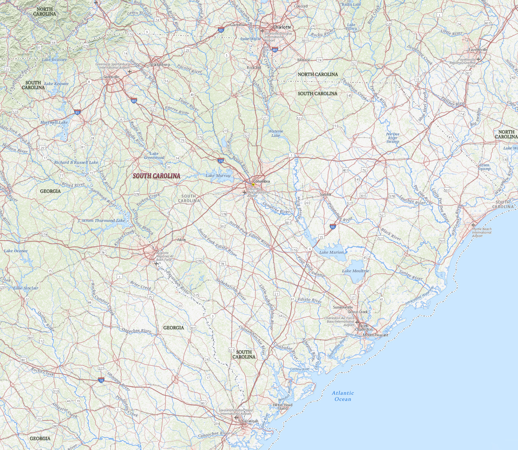
Map of South Carolina
South Carolina is a state on the Atlantic coast of the USA, between North Carolina and Georgia. The three principal rivers are the Santee, Great Pee Dee and Savannah rivers. South Carolina’s coastline extends for 301 km. The capital and is Columbia and the largest city is Charleston.
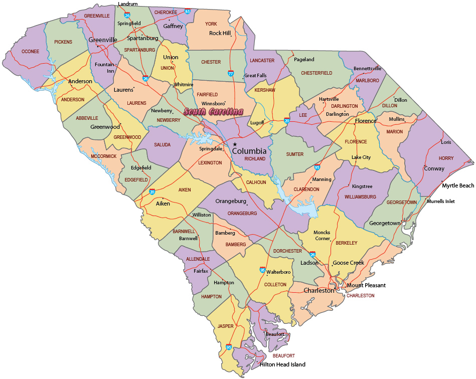
Political Map of South Carolina

Lighthouse and marina in the Hilton Head Island - SC, noted for its recreational activities.


Map of South Carolina
|
Copyright © Geographic Guide - Travel United States of America. |
Source (edited): USGS National Map.