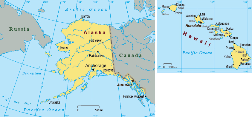
Map of USA

|
Copyright © Geographic Guide - Travel American Continent. |
The United States of America has a total area of 9,833,517 km², the fourth largest country in the world. The country is politically divided into a federal district and 50 states: Alabama, Alaska, Arizona, Arkansas, California, Colorado, Connecticut, Delaware, Florida, Georgia, Hawaii, Idaho, Illinois, Indiana, Iowa, Kansas, Kentucky, Louisiana, Maine, Maryland, Massachusetts, Michigan, Minnesota, Mississippi, Missouri, Montana, Nebraska, Nevada, New Hampshire, New Jersey, New Mexico, New York, North Carolina, North Dakota, Ohio, Oklahoma, Oregon, Pennsylvania, Rhode Island, South Carolina, South Dakota, Tennessee, Texas, Utah, Vermont, Virginia, Washington, West Virginia, Wisconsin, Wyoming.
The District of Columbia is a federal district that contains the city of Washington, the capital of the U.S.A.


More: Historical maps of New York City ►
(Source: USGS)
Map of USA
Political map
