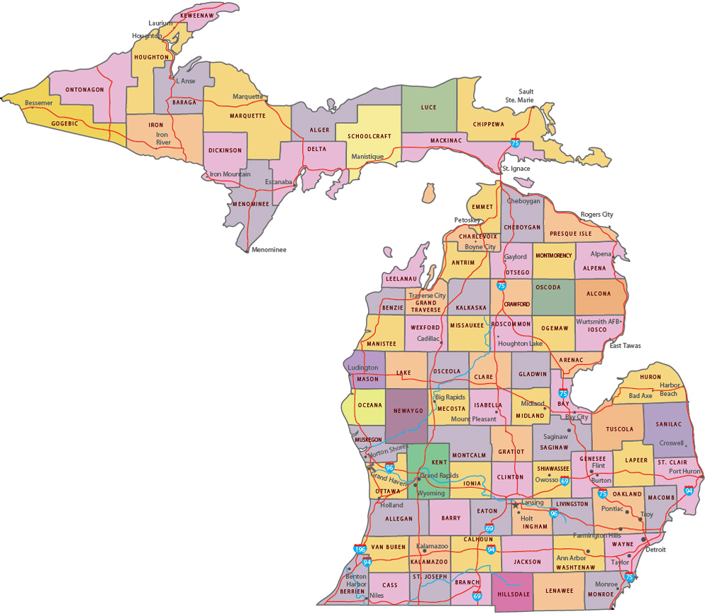
Map of Michigan

◄ Michigan
Michigan was admitted in 1837 as a state of the U.S.A. The capital is Lancing and the largest city is Detroit. It is bounded on the south by the states of Ohio and Indiana. The state has water boundaries in the Great Lakes: Michigan, Erie, Huron and Superior. It has land boundary with Wisconsin in the Upper Peninsula. There is the border with the Canadian province of Ontario to the north and east.


Church in Mackinac Island, State of Michigan.
|
Copyright © Geographic Guide - Travel, American Continent. |
Detroit, the largest city of Michigan.
Political Map of Michigan

Source (edited): U.S. Geological Survey.
Photo Vito Palmisano