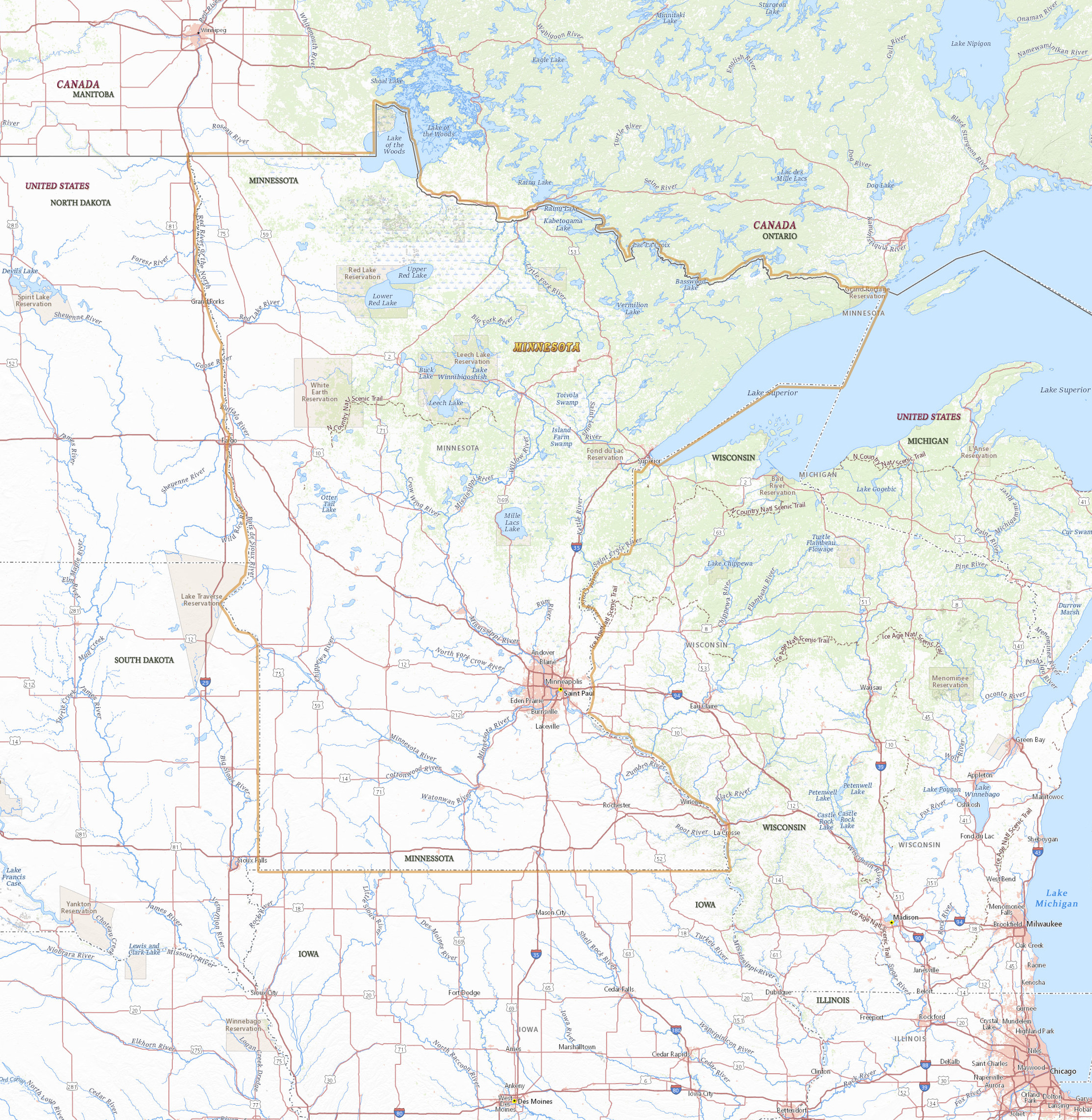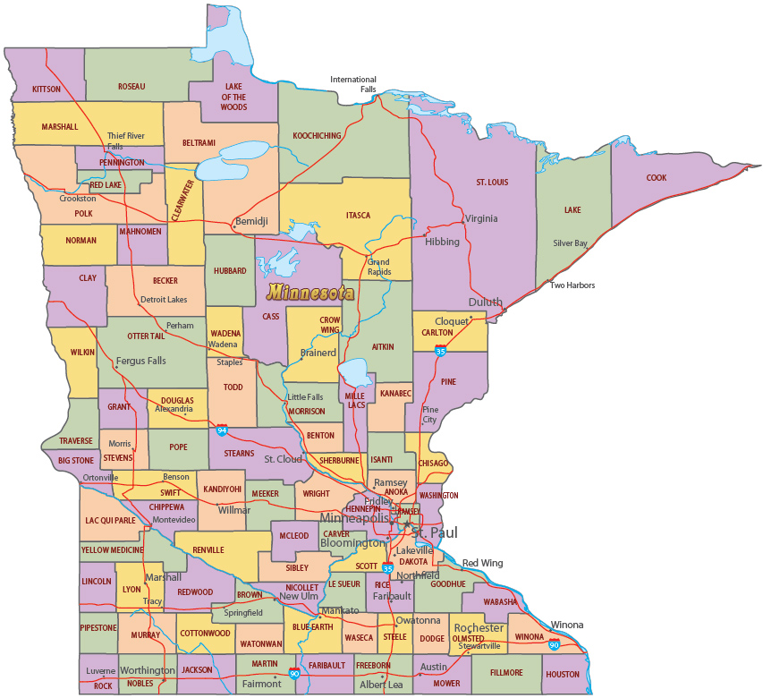
Map of Minnesota
Buildings in Minneapolis, Minnesota's largest city.
Minnesota is a state in the north central United States. It entered the Union in 1858. The name comes from a Sioux word meaning “cloudy water” used for the Minnesota River. The capital is Saint Paul and the largest city is Minneapolis. Minnesota is bordered by the Canadian provinces of Ontario and Manitoba, on the north, and by the U.S. states of North Dakota, South Dakota, Iowa and Wisconsin.

Political Map of Minnesota


Map of Minnesota
|
Copyright © Geographic Guide - Travel American Continent. |
Source (edited): USGS National Map.
