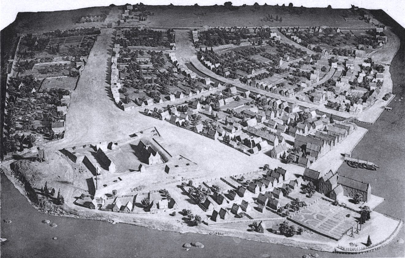
New Amsterdam in 1660 - Scale Model
Scale Model of New Amsterdam (now New York), in 1660, probably based on the Castello Plan. Detail below. Photographs published in postcards in 1932. Source: Museum of the City of New York.
In the foreground is Fort Amsterdam and in the lower right corner is Peter Stuyvesant's house on Whitehall Street. The East River is to the right. The canal (Heere Graft or Heeren Gracht) runs down what is now Broad Street. It was filled in by the British about 1676.
In the background is the city gates and the citadel wall, where Wall Street now runs. In 1653, during the First Anglo-Dutch War, a stockade wall was built along the northern edge of the city to block an invasion from the English forces.
More: Maps of NYC - 17th Century ►


New Amsterdam in 1660 - Scale Model

|
Copyright © Geographic Guide - 17th Century NYC. New Amsterdam. |