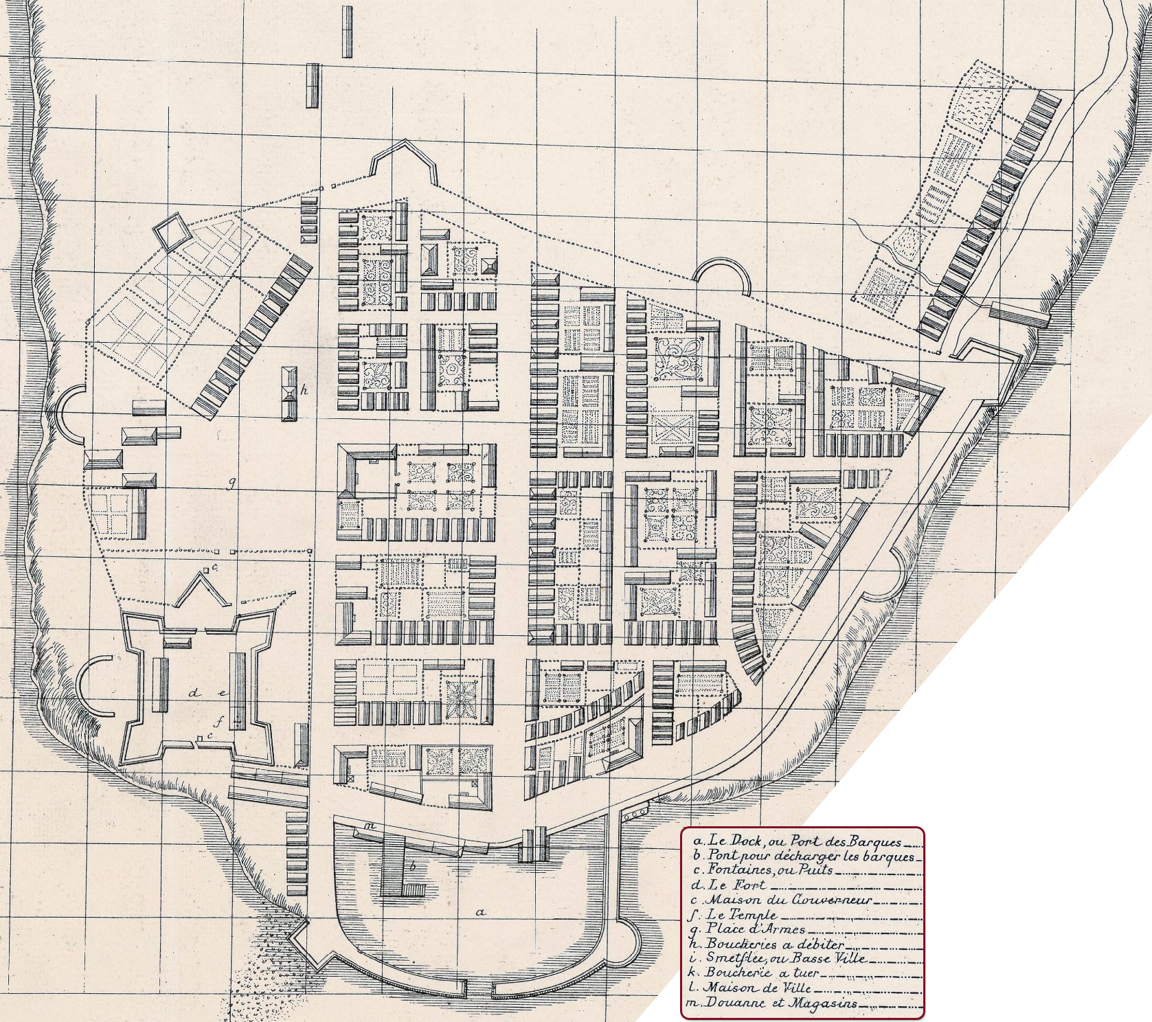
Plan de Manathes ou Nouvelle Yorc, Jean-Baptiste Franquelin - 1693
Plan de Manathes ou Nouvelle Yorc by Jean-Baptiste Franquelin (1650-c.1712), dated 1693. Facsimile reproduction [cut to fit this web page] from Bibliothèque Nationale de France, département cartes et plans, Service hydrographique de la marine consacrée à la ville de New York. References are on the right.
Here, some comments about this plan, on a manuscript on paper (owned by the Dépôt de la Marine, Paris - possibly and earlier version of this plan), from Isaac Newton Phelps Stokes, who called it "The Franquelin Plan" (The Iconography of Manhattan Island, ... 1915): «Verified by le Sieur de la Motte (probably the same Sieur, or Chevalier de la Motthe, who, on Sept. 15, 1688, as Major and second in command of Fort Niagara, signed a memorandum describing the condition in which said fort was on that date abandoned by order of the Governor-General...
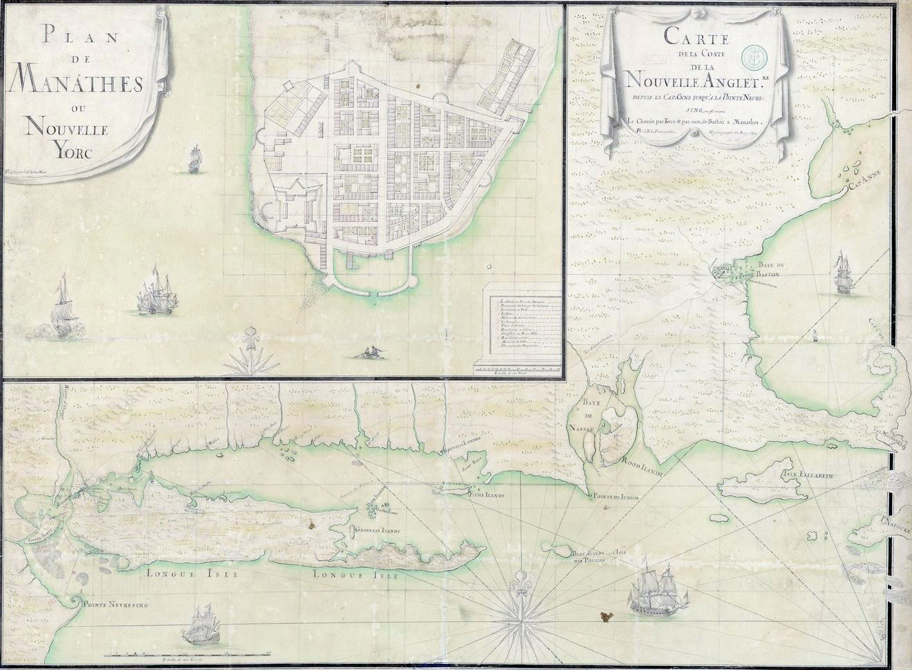
This plan is an inset in a large map by Franquelin of the coast of New England from Cape Anne to Point Nebresing [on the right]. The full title of this beautifully drawn, although not altogether reliable, map is “Carte de la côte de la Nouvelle-Angleterre depuis le cap Anne jusqu’à la pointe de Nebresing, où est compris le chemin par terre et par mer de Baston à Manathes, par I. B. L. Franquelin, hydrographe du roi, 1693.”...
...The Dépôt de la Marine contains several other interesting maps of the North East Coast, drawn by Franquelin in Quebec, and showing the Island of Manhattan, one of which, marked 4040B 6bis, is dated 1681.
See Gabriel Marcel’s Reproductions de cartes & de globes, etc., p. 27, and the accompanying portfolio (plate 6), for a reproduction of the “Plan de Manathes,” from which reproduction our plate is made...
It is quite probable that the plan here reproduced was made for military purposes, as the Paris Documents of this period contain many references to a contemplated but never executed attack upon New York by the French.»


Carte de la Coste de la Nouvelle Angleterre by Jean-Baptiste Franquelin with the inset of New York. Source: Bibliothèque Nationale de France.


|
Copyright © Geographic Guide - 17th Century NYC. Historical Maps. |
Plan de Manathes ou Nouvelle Yorc, Jean-Baptiste Franquelin - 1693