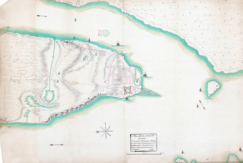
Plan de Nouvelle York by Chevalier d’Aux - 1692
Plan de la Nouvelle York by Chevalier d’Aux, dated 1692 (on the right). Source: Bibliothèque Nationale de France, département cartes et plans, Service hydrographique de la marine consacrée à la ville de New York.
Continue below...
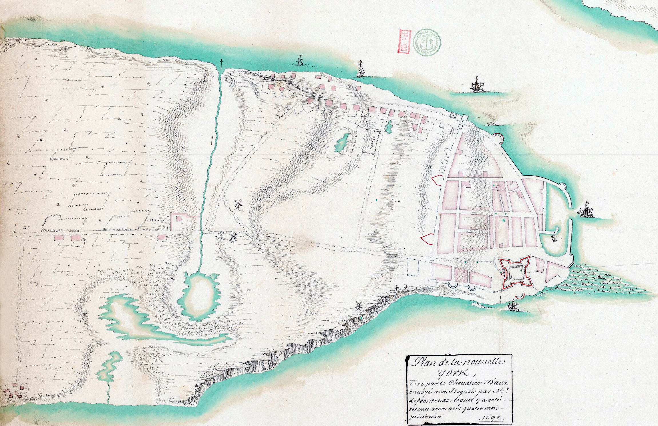
Above, enlargement of the southern Manhattan.
Chevalier d’Aux was sent to the Iroquois by Monsieur de Frontenac. He also was the author of a fine, large plan of Boston and its environs, dated 1672, and preserved in the archives of the Dépôt de la Marine, Paris.
Here, some comments about this plan from Isaac Newton Phelps Stokes (The Iconography of Manhattan Island, ... 1915): «The plan here reproduced is particularly interesting as giving a good idea of the fortifications existing at this period and of the road system outside of the walls of the city. It also shows very distinctly the positions of the three wind-mills. The wind-mill shown on the Hudson River, west of Broadway, was erected prior to 1686 by Peter Jansen Mesier, who acquired the lot upon which it was built from the heirs of Olof Stevensen Van Cortlandt. A lane about fifteen feet wide, belonging to Mesier and called in early records ‘‘Pieter Jansen’s Lane,” intervened between Mesier’s property and the lot on the south. This lane was situated about 1oo feet north of the present Liberty Street, and 110 feet south of Cortlandt Street, and was later referred to as “Old Windmill Lane,” because it led from Broadway to the wind-mill, which stood about the middle of the present Cortlandt Street [see Lyne Survey]...
The Collect is here erroneously shown on the west side of Broadway. Notice also that the Water Mill, or Old Mill, shown both on “‘The Duke’s Plan” and on the Nicolls Survey, at the mouth of the outlet from the Collect, has disappeared.»
Enlargement of the southern Manhattan.

|
Copyright © Geographic Guide - 17th Century NYC. Historical Maps. |
Plan de Nouvelle York by Chevalier d’Aux - 1692
Click on image to enlarge.
