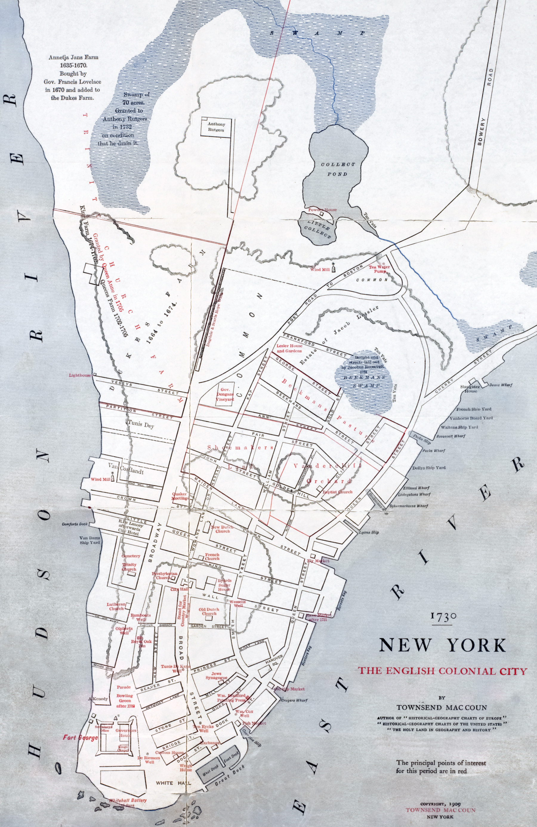
New York, English Colonial City - 1730
Map made by Townsend MacCoun (1845-1932) and published in 1909. Original title: 1730 - New York - The English Colonial City. It shows the historical and physical setting of New York City (Manhattan Island) in the 1730s. The principal points of interest for this period are in red. Source: New York Public Library.
In 1730, the population of New York City was 8,622 people. At that time, New York City was developing in leaps and bounds. The City's first newspapers, such as the New-York Gazette (1725) and the New-York Weekly Journal (1733) were published. In 1732, the city's first theater opens near Maiden Lane.
More: Maps of NYC - 18th Century ►

More: Historical maps of New York ►
|
Copyright © Geographic Guide - 18th Century NYC. Historic Maps. |

New York, English Colonial City - 1730