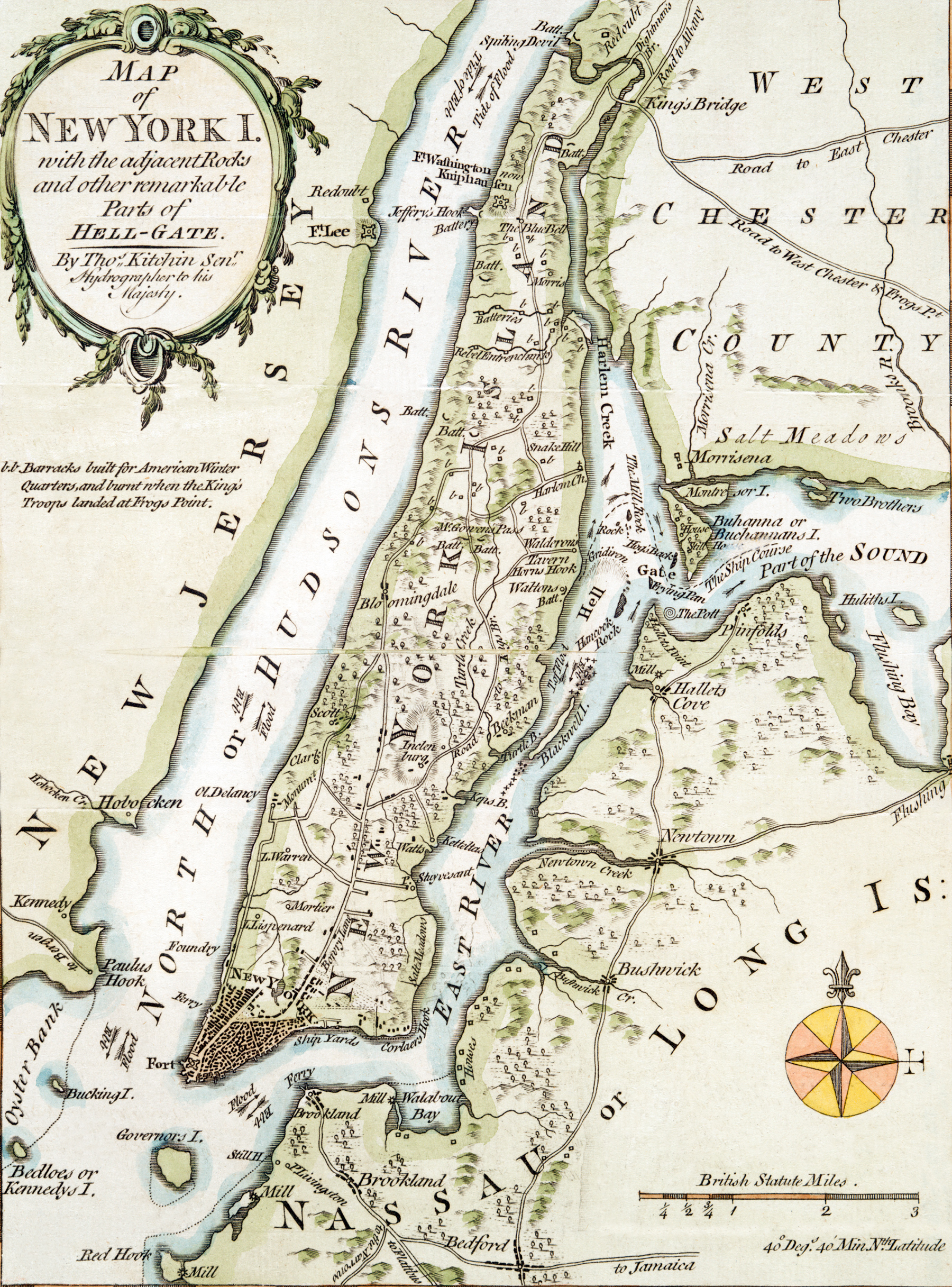
Map of New York Island - 1778
Map of Manhattan Island and environs by Thomas Kitchin Senr (1718-1784)hydrographer to his Majesty, for the London Magazine 1778. Relief shown pictorially. Original title: Map of New York I. with the adjacent Rocks and other remarkable Parts of Hell-Gate. Printed for R. Baldwin at the Rose in Pater Noster Row. Source: New York Public Library.
This map was made during the British occupation of New York, from 1776 to 1883, during the Independence War. It shows several points of interest with their names at the time such as Brookland (now Brooklyn), the Ship Yards on the East River waterfront, Blackwell Island (now Roosevelt Island), Bowry Lane (Bowery), Bloomingdale, King's Bridge and many others. At the time the city did not go further north beyond the Commons (now City Hall Park).
|
Copyright © Geographic Guide - Geography 18th Century NYC, Maps. |
(Manhattan)


Map of New York Island - 1778