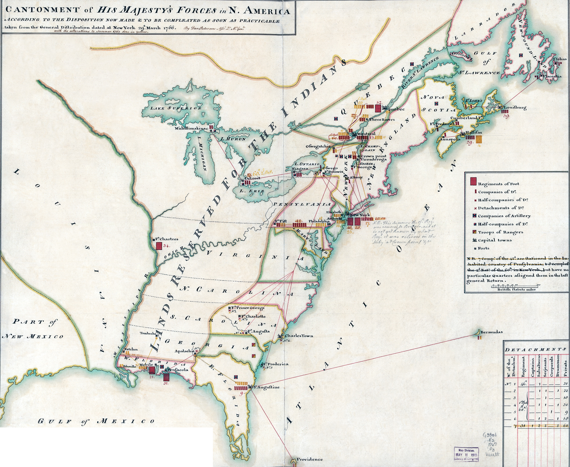
Map of British Forces in Provinces of North America - 1767
Historical map of the British Colonies of North America, in 1766-1767. by Daniel Paterson (1738-1825). Original title: Cantonment of His Majesty's Forces in N. America According to the Disposition now made & to be Compleated as Soon as Practicable taken from the General Distribution dated at New York 29th. March 1766, with the alterations to summer 1767 done in yellow. By 1781, Dan Paterson was assistant to the Quarter-Master-General of His Majesty's Forces. Source: Library of Congress Geography and Map Division Washington, D.C.
This map was made after the French and Indian War (1754–1763) and the "Lands reserved for the Indians" in the map was formerly part of the French territory in North America.
The political structure shown on the map changed greatly after the Revolutionary War (1775-1783). In 1775, thirteen British colonies on the Atlantic coast of North America started a war of independence against Great Britain. The Declaration of Independence was adopted on July 4, 1776.
More: Historical maps of United States ►

|
Copyright © Geographic Guide - Historical Geography, American Continent. 18th Century. |

Map of British Forces in Provinces of North America - 1767