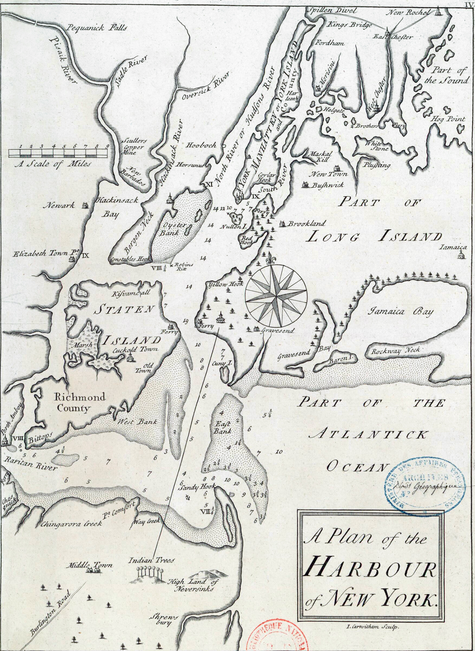
![]() Original title: A Plan of the Harbour of New York.
Engraved on copper by J. Carwitham (on print "I. Carwitham Sculp."). Year
depicted by Stokes (Iconography of Manhattan Island, ... 1915): about 1730. Year issued: about 1735.
Published alongside a City map. Source: Département Cartes et
Plans, Bibliothèque nationale de France (BnF). No other copy known. Included
in a collection of four volumes, two of which contain loose maps, plans, and
views of the United States, and two, similar documents relating to other parts
of America.
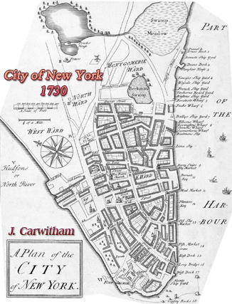
Original title: A Plan of the Harbour of New York.
Engraved on copper by J. Carwitham (on print "I. Carwitham Sculp."). Year
depicted by Stokes (Iconography of Manhattan Island, ... 1915): about 1730. Year issued: about 1735.
Published alongside a City map. Source: Département Cartes et
Plans, Bibliothèque nationale de France (BnF). No other copy known. Included
in a collection of four volumes, two of which contain loose maps, plans, and
views of the United States, and two, similar documents relating to other parts
of America.