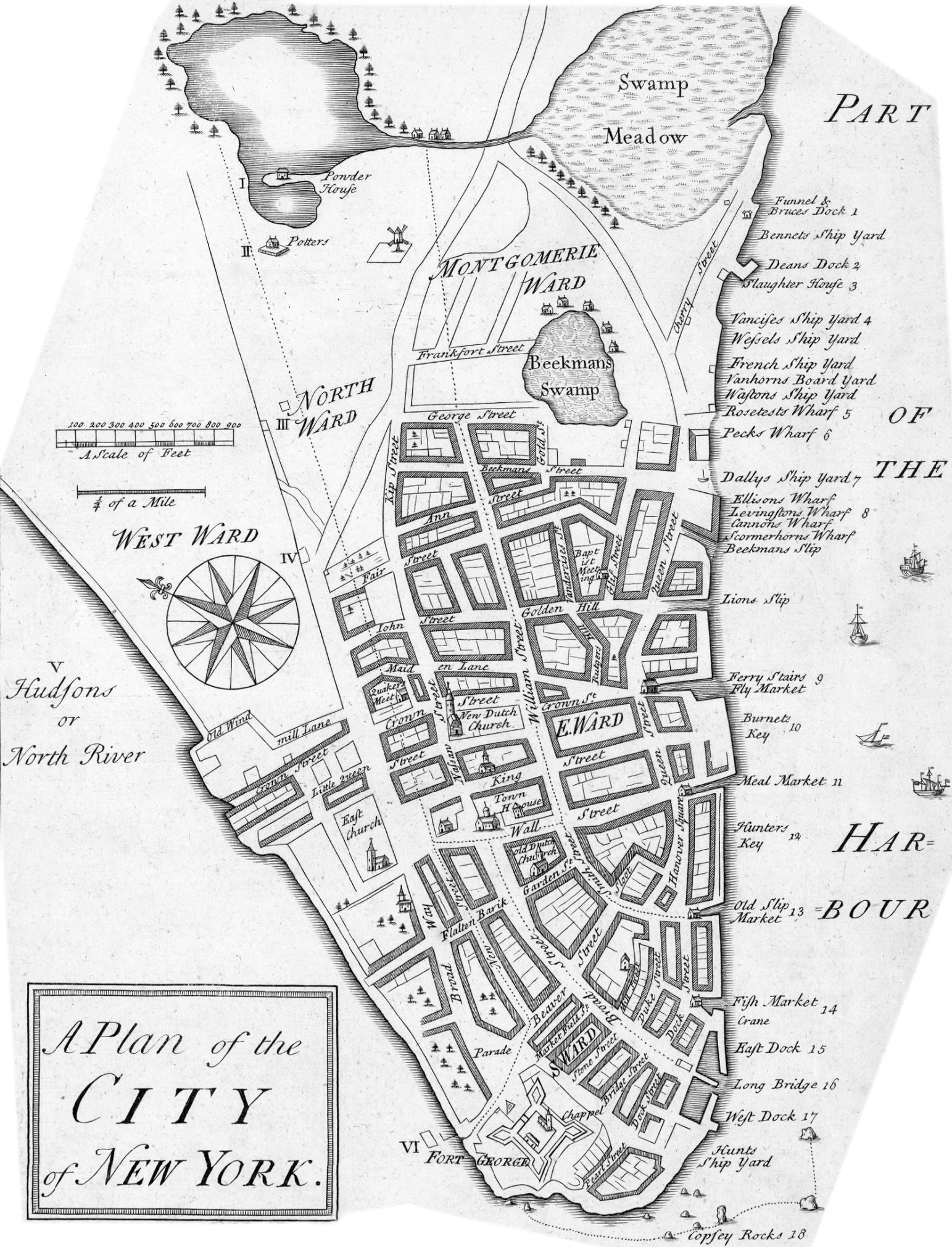
Original title: A Plan of the
City of New York. Engraved on copper by John Carwitham. Year
depicted by Stokes (Iconography of
Manhattan Island, ... 1915): about 1730. Year issued: about 1735.
Published alongside a Plan of the Harbour of New York
by the same author. Source: Département Cartes et
Plans, Bibliothèque nationale de France (BnF). More about this map is
published below.
John Carwitham is also the engraver of the View of Fort George
with the City of New York.
Author of illustrations in the books (all published in
London): Essay in Defence of Ancient Architecture... (1728), Art of Painting by
Gerard de Lairesse (Amsterdam, 1707 - London, 1738), Floor-decorations of
various kinds... (1739) and The gentlemens or builders companion... (1739).
More:
Maps of NYC - 18th Century ►
The following text is an explanation about this map from
Stokes (Iconography of Manhattan Island, ...1915):
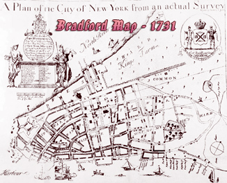
This Plan was evidently engraved by the same hand as “A View
of Fort George with the City of New York from the S W”, known from the name of
its engraver as the “Carwitham View”. It was apparently drawn at about the same
period as Bradford’s Map, although some additions
as well as omissions show that even if copied from it an attempt was made to
bring it up to date. Note, for instance, the ‘‘Potters” house, south-west of the
Little Collect Pond. No such name appears on any other plan of the period,
although David Grim marks at about this same place
on his plan, drawn from memory, two potters’ houses—‘‘Corselius’ Pottery” and
“Remmey & Crolius’ Pottery’’, and the Bradford Map has an unnamed building in
this neighborhood. We know that, later on, the city owned a pottery here, for we
find in the Minutes of the Common Council, under date of October 30, 1760, the
following reference: ‘‘Order’d that Alderman Filkin Alderman Bogart and Alderman
Mesier, Messrs. Roosevelt and Randell or the Major part of them be a
Committee to Treat with Mr. Henry Van Vlack Concerning the Rent of
the Pott Bakers House Belonging To this Corporation near the Negroes Burying
Place”. This is probably the “Potters” house shown on our plan. On the Duyckinck
Map of 1755, two “Pot Baker” houses are marked in this vicinity.
A number of errors in spelling, while perhaps due to
carelessness in copying, indicate also a lack of familiarity with the
nomenclature of the places represented, which leads to the conclusion that the
work was not done from original surveys.
Perhaps the most interesting feature of the Plan of the City
is the delineation in tiny bird’s-eye perspective of a number of the most
important buildings, such as the First Presbyterian Church, on Wall Street, the
Dutch Church on Garden Street, and the Jews’ Synagogue on Mill Street.