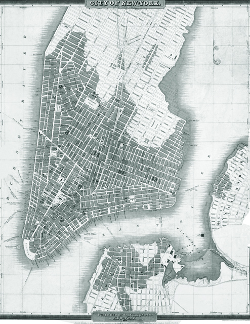
Map of New York City by David H. Burr - 1833
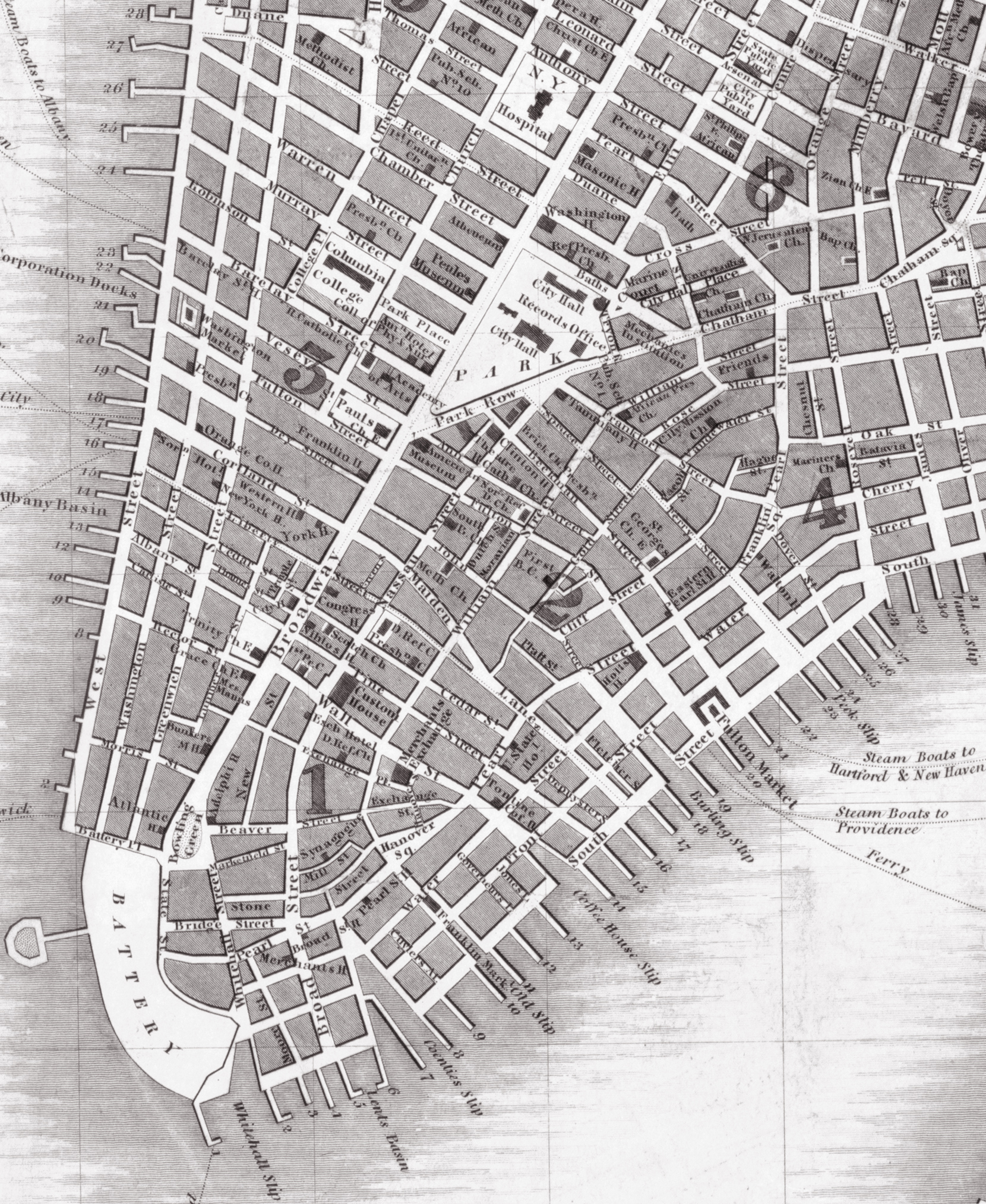
Map of Lower Manhattan, Brooklyn and Williamsburg by David Hugh Burr (1803-1875), dated 1834, copyright 1833. Engraved & printed by S. Stiles & Co. Published by J.H. Colton & Co. Original title: City of New York. Source: Library of Congress Geography and Map Division. Below, enlargement of part of Lowe Manhattan.
The Tompkins Square, between 7th and 10th streets, recorded in this map, was created on April 9, 1833, (then referred as Clinton Square). It received its present name on July 30, the same year. This is interesting considering this map is dated 1834, but copyrighted 1833. In his map dated 1832, Burr recorded the place as "Proposed Square" and, as Clinton Square, in his earlier 1833 map of NYC.
The map shows Administrative divisions (Wards); street names until 26th Street, west side, and 40th Street, east side; main points of interest; ferry and steam boat routs. It was drawn about two years before the Great Fire of 1835, which destroyed almost 700 buildings in Lower Manhattan.
Williamsburgh or Williamsburg was annexed into the City of Brooklyn in 1855. Brooklyn became part of New York City in 1898.

Map of New York City by David H. Burr. Click on the image to enlarge.

|
Copyright © Geographic Guide - Historic Map 19th Century NYC. |
Map of New York City by David H. Burr - 1833