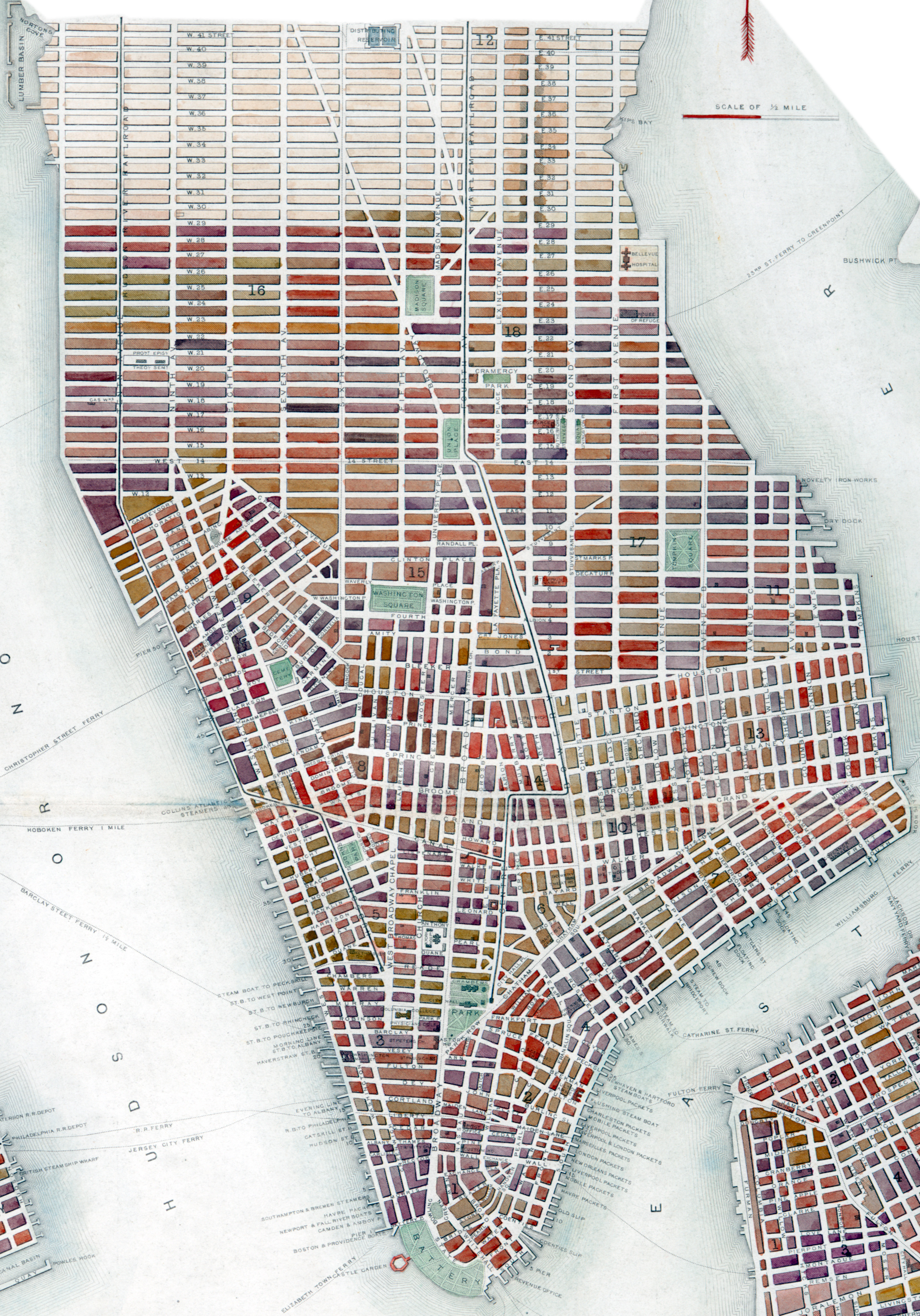
Map Manhattan by J. Rapkin - 1851
This is a fragment of the Plan of New York, showing the part of Manhattan from 42nd Street south to the Battery. It also shows Manhattan wards, ferry lines, docks, and slips. It was drawn and engraved by John Rapkin (1845-1851), published by John Tallis & Co. in 1851 Source: Maps of New York City and State from the New York Public Library.
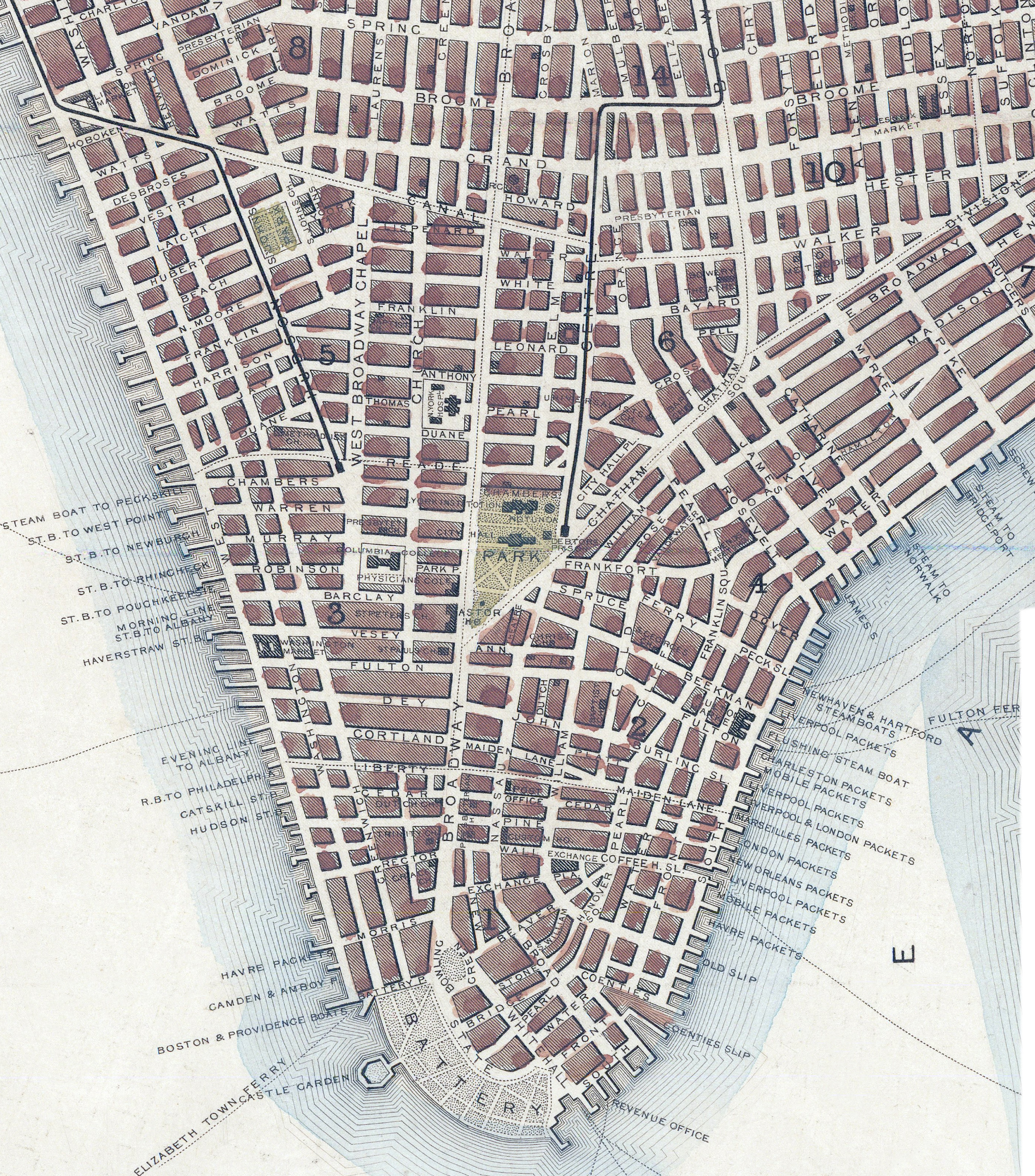
John Tallis (1815-1876) was an English cartographic publisher. His company John Tallis and Co, was based in London, and later expanded to Edinburgh, Dublin and New York. He worked closely with John Rapkin. Below, enlargement of the tip of Manhattan from a copy of this map from Barry Lawrence Ruderman Antique Maps Inc. More: Maps of NYC - 19th Century ►


Map Manhattan by J. Rapkin - 1851
|
Copyright © Geographic Guide - Maps of 19th Century NYC. |