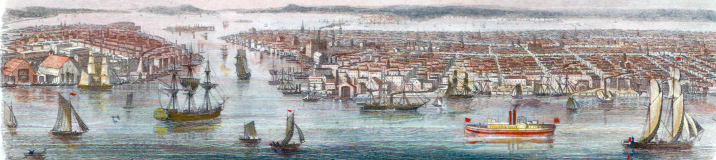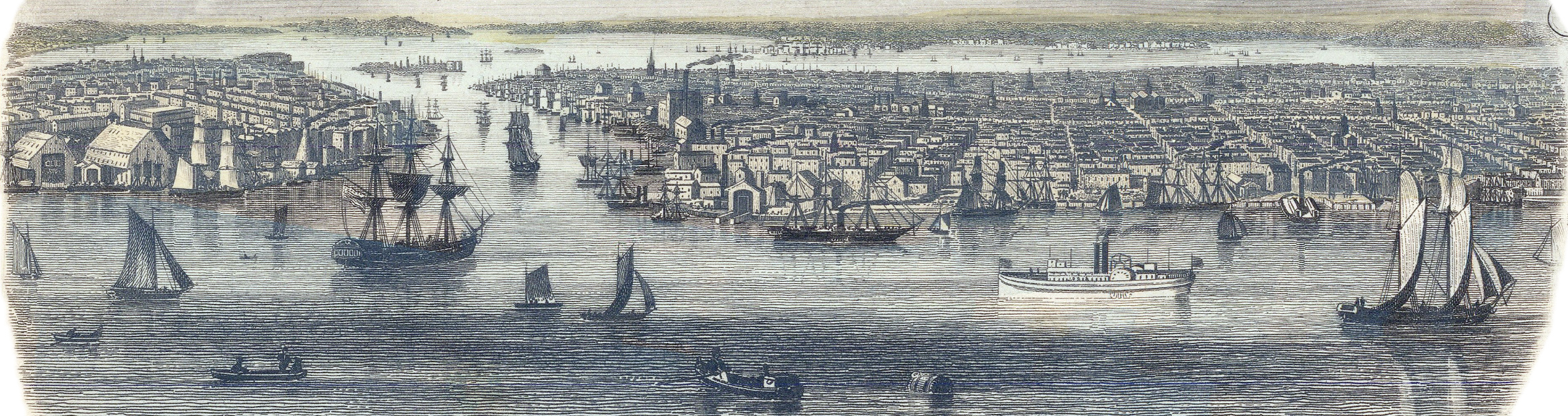
East River, Brooklyn and Manhattan, from Williamsburg - 1851
View of the East River and ships from Williamsburg, with Brooklyn on the left and Lower Manhattan on the right. Illustration drawn and engraved by H. Winkles, published by John Tallis & Co., London & New York. This image is an inset from the Plan of New York by J. Rapkin. Source: Barry Lawrence Ruderman Antique Maps Inc. On the right, the same illustration, with a richer color set, from a copy from the New York Public Library.
Despite its name, the East River is actually a tidal strait. Brooklyn and New York waterfronts feature a variety of industrial facilities.
After the 1830s, the garment industry became the New York City’s largest industry. There were both changes in demand and production technology that turned the City into a center of ready-to-wear clothes. Mechanization greatly decreased the costs of mass production relative to custom tailoring.
|
Copyright © Geographic Guide - Waterfront 19th Century NYC. |

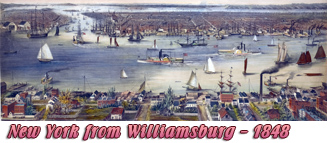

East River, Brooklyn and Manhattan, from Williamsburg - 1851