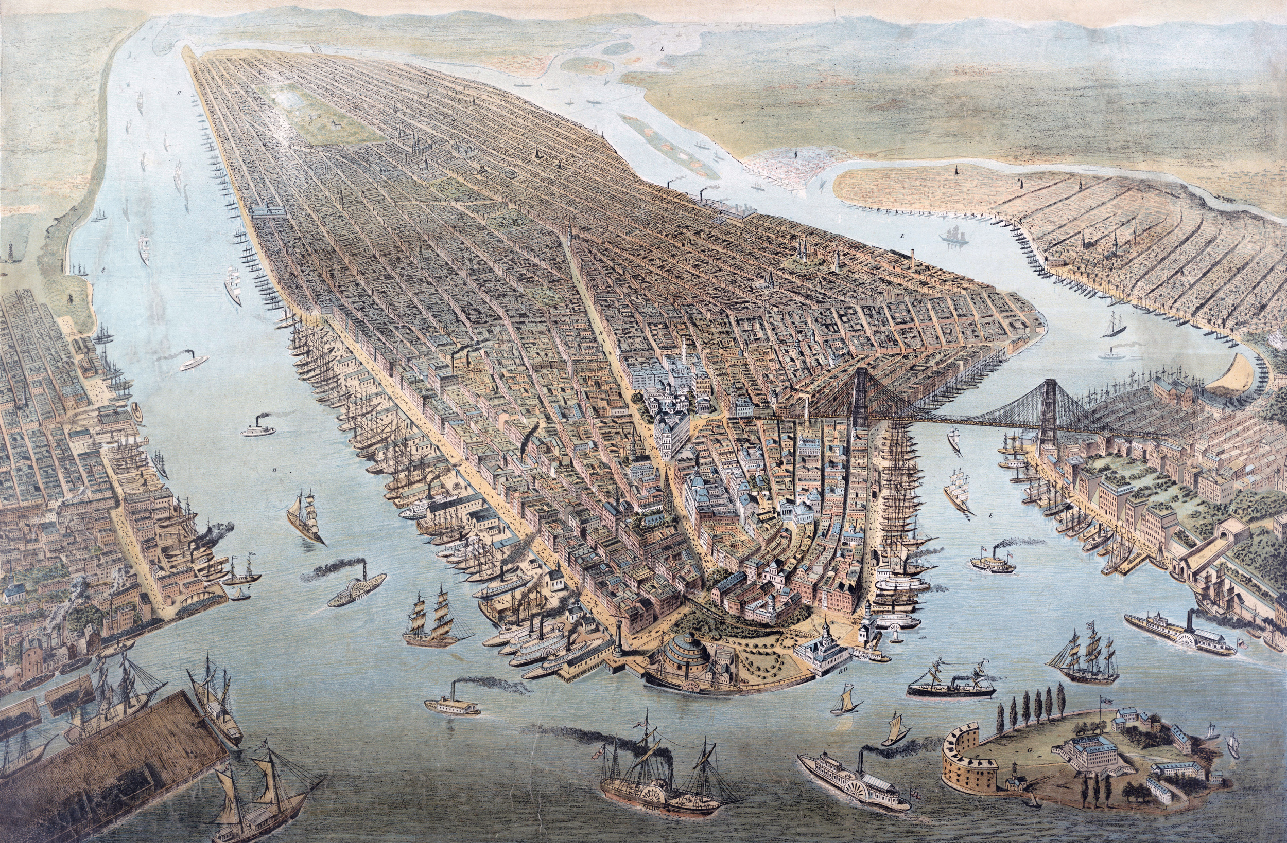
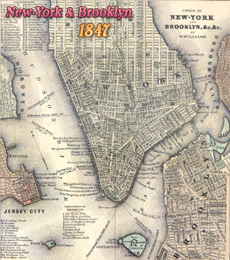
Manhattan Island - 1881
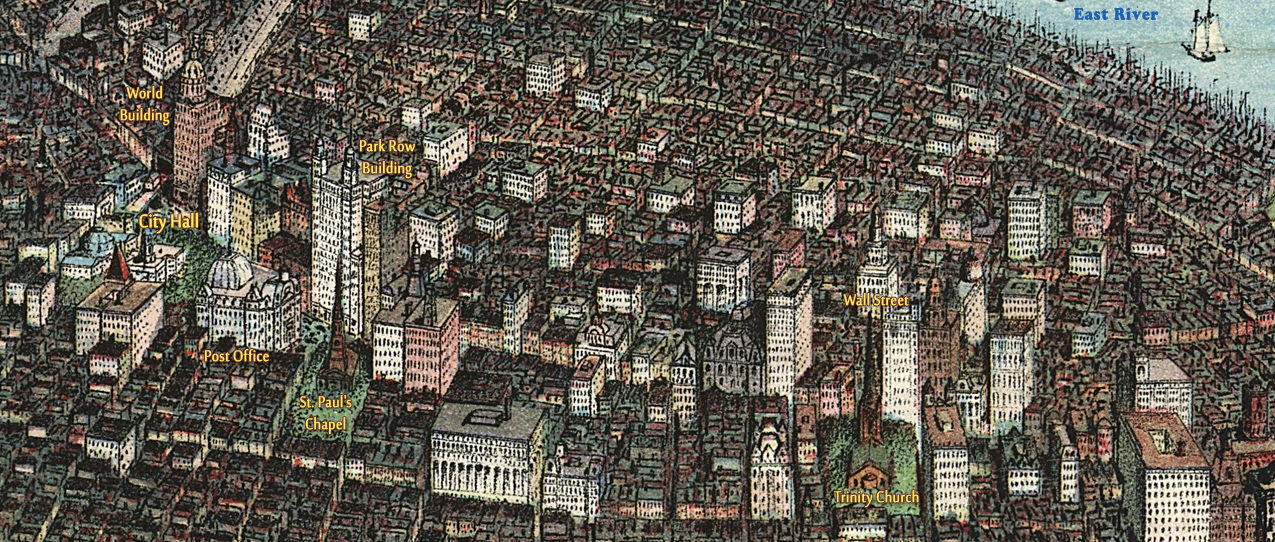
Panoramic View of New York City. The year depicted is about 1881 or 1882, when the Barge Office was completed at the Battery. Its construction began in 1880 and is shown here with a different architecture, possibly because it was not completed at the time of the drawing. In 1882 the old Post Office (shown here) at Nassau Street, former Middle Dutch Church, was demolished. The Brooklyn Bridge terminal, which opened in 1883, is erroneously positioned south of the Tribune Building and the terminal itself is not shown, the reason probably being that it had not yet been built. Chromolithograph published by F. E. Wachsmuth in Leipzig 1898, for use in German schools (Leipziger Schulbilderverlag). Chromolithograph on wove paper mounted on linen. Source: Columbia University Libraries. Below, enlargement of Lower Manhattan.
The view shows Manhattan Island and its environs, looking northeast from the Upper Bay. Although unsigned, the engraving is attributed to German artist Mathieu Molitor (1873-1919). Governors Island is shown in the lower right corner and Battery Park, Castle Garden and the Barge-Office are on the southern tip of Manhattan. City Hall Park and Lower Broadway are shown in detail. The Central Park appears in the distance. Brooklyn Bridge is still the only bridge in the city across East River. Brooklyn is on the right and New Jersey, on the left.
Hudson River
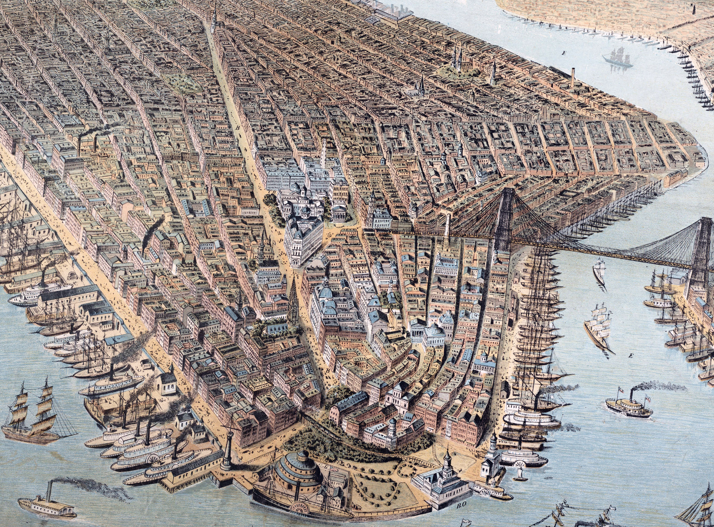
Below, fragment of Downtown Manhattan from an illustration published by Joseph Koehler, © 1905, showing buildings on Lower Broadway, Park Row and City Hall Park.

East River
Panoramic View
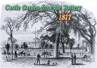
Castle Garden
Manhattan Island - 1881
|
Copyright © Geographic Guide - 20th Century NYC. |
Barge Office