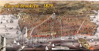
Greater New York in the Early 20th Century
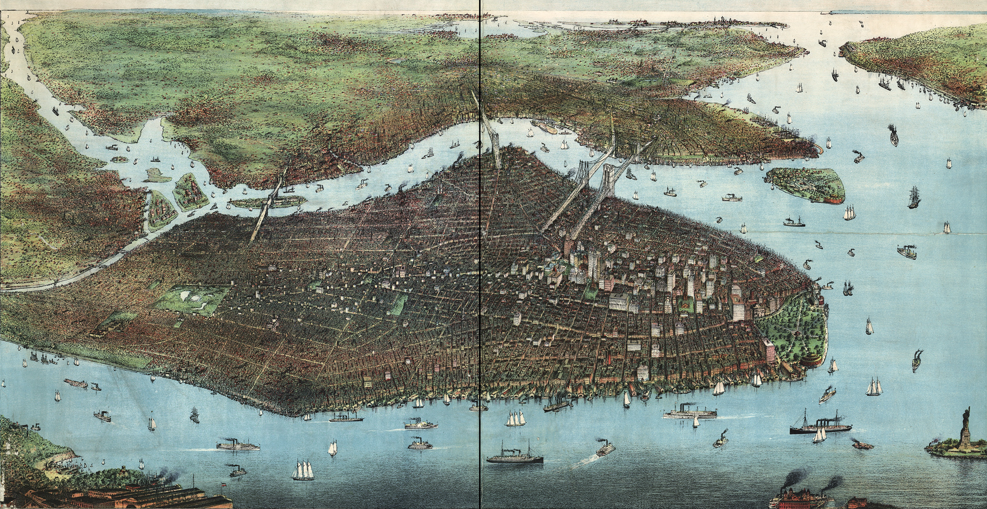
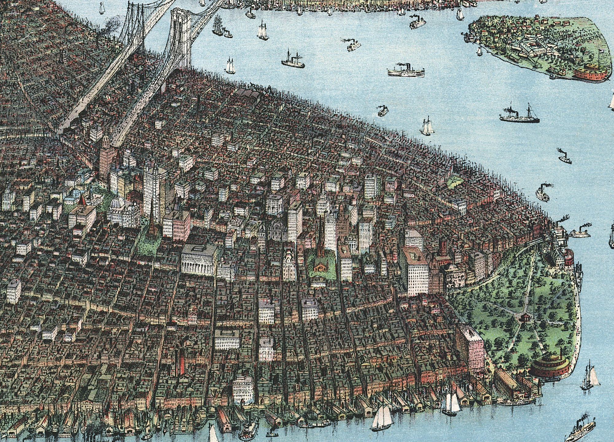
View of Greater New York with Battery Park on the right and showing the boroughs of Bronx, Queens, Manhattan, Brooklyn, and Richmond, with the Hudson River in the foreground. Illustration by Charles Hart, published by Joseph Koehler, © 1905. Source: Library of Congress Prints and Photographs Division Washington, D.C. Below, enlargement of Downtown Manhattan.
The North River and the East River converge here and flow to the Atlantic Ocean. Twenty five years before Trinity Church was the city's tallest structure. In 1890 it was surpassed by the World Building and taller skyscrapers had been built since then, along with them developed public buildings, railways, tunnels, bridges, parks, piers, ferries and the vast and intricate affairs connected with a great metropolis.
More: Historical maps of New York City ►


Greater New York in the Early 20th Century


|
Copyright © Geographic Guide - 20th Century NYC. Maps of American Cities. |