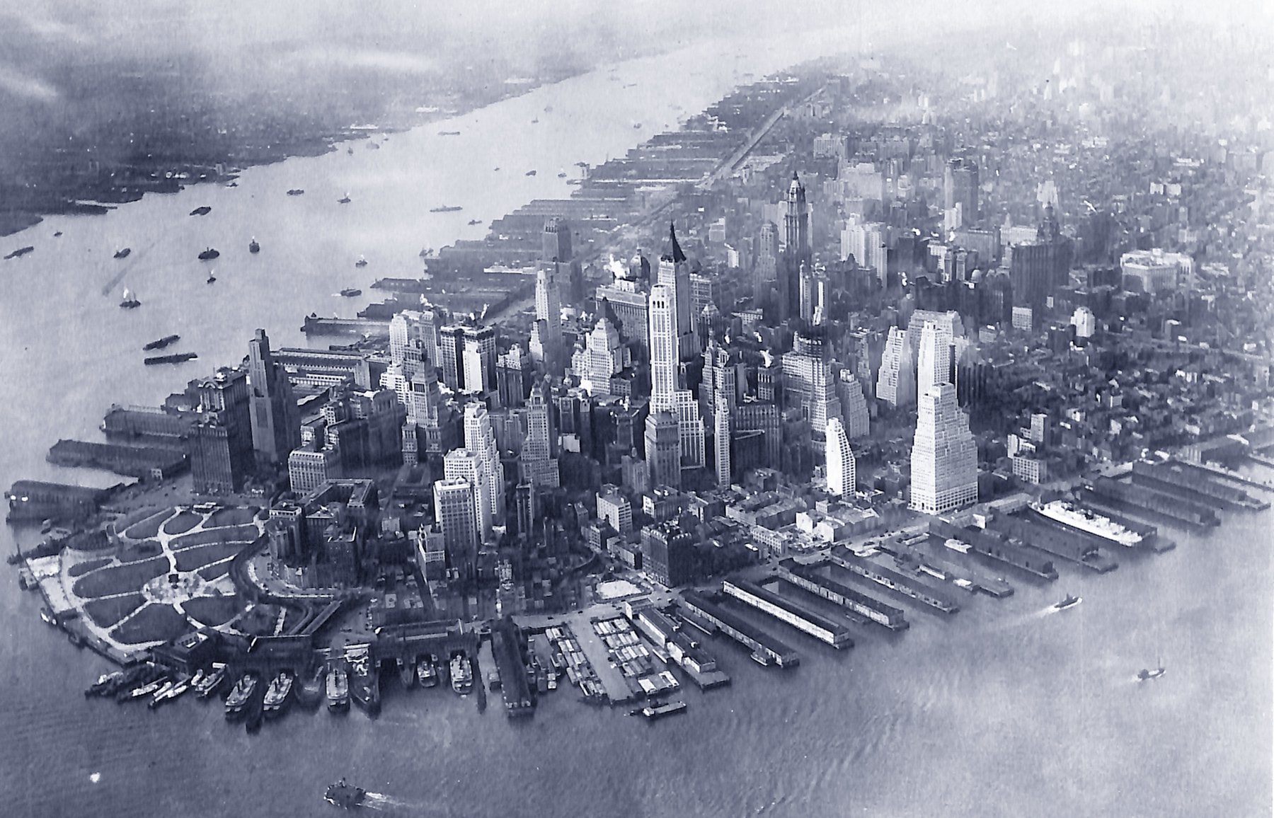
Aerial Photograph of Lower Manhattan - 1931
Aerial photo of the southern tip of Manhattan Island taken in 1931. Original caption: Aerial view of New York skyline. Photograph from Headquarters 1st Mapping Group Bolling Field - Washington, D.C. Source: U.S. National Archives.
The year 1931 is estimated based on the construction of the American International Building, 70 Pine Street. In this picture, the building is seen under construction, which started in 1930 and was completed in May 1932. The New York Times reported in April 1931 that the steel had been erected to the 27th floor. The spire was installed in October 1931.
This region has been unfolding over centuries. From the times of the Dutch settlers until the 20th century, approximately 900 acres of land have been added to the coasts of Southern Manhattan. That year of 1931, however, New York was under the Great Depression.


|
Copyright © Geographic Guide - 20th Century NYC. Aerial Photo Lower Manhattan. |

Aerial Photograph of Lower Manhattan - 1931