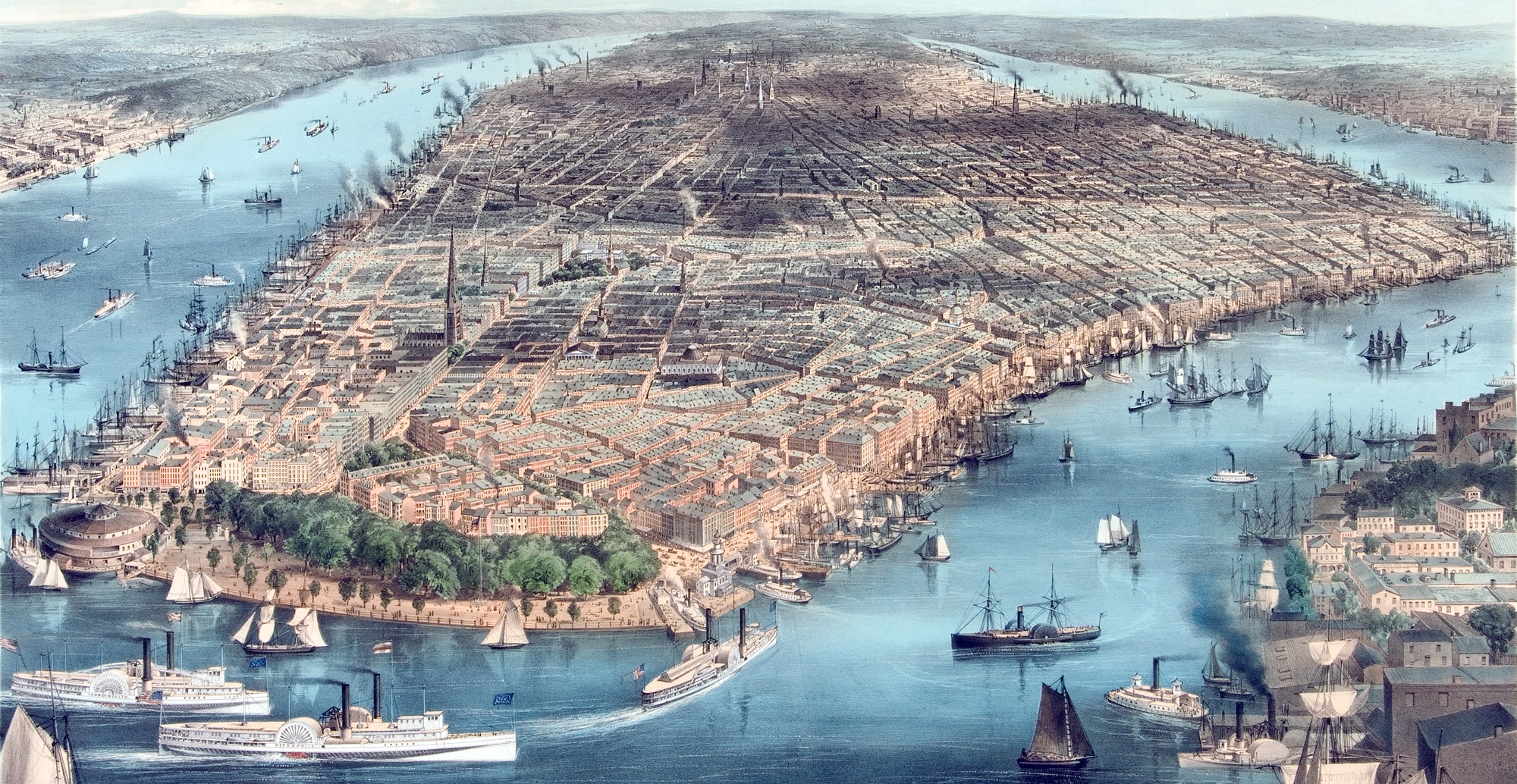
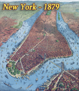
City of New York - Panoramic Illustration, 1856
View of the City of New York with Battery Park in the foreground and Brooklyn Heights in the lower right corner. Sketched and drawn on stone by Charles Parsons (1821-1910). Published by N. Currier, originally in 1856 in two color engraving (see enlargements (brown) below from a copy from the Library of Congress Prints and Photographs Division). The color drawing above is from the Mabel Brady Garvan Collection, Yale University Art Gallery.
The Crystal Palace, built for the Exhibition of the Industry of All Nations, 1853 / 1854, is represented in the distance, at Sixth Avenue and 42nd Street. It was destroyed by fire in 1858.
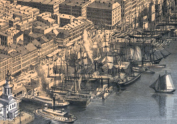
The North River and the East River converge here and flow to the Atlantic Ocean. After the opening of the Erie Canal, in 1825, Manhattan became the busiest port on the East coast of the United States.
In the 1850s, New York was flooded by Irish immigrants flying from famine after a mysterious blight decimated Ireland’s potato crop. In 1855 one out of four resident in New York City was an Irish famine refugee.
In the 1850s, New York was flooded with Irish immigrants fleeing famine after a mysterious blight decimated Ireland's potato crop. In 1855, one in four residents of New York City was an Irish famine refugee.
More: Historical maps of New York City ►
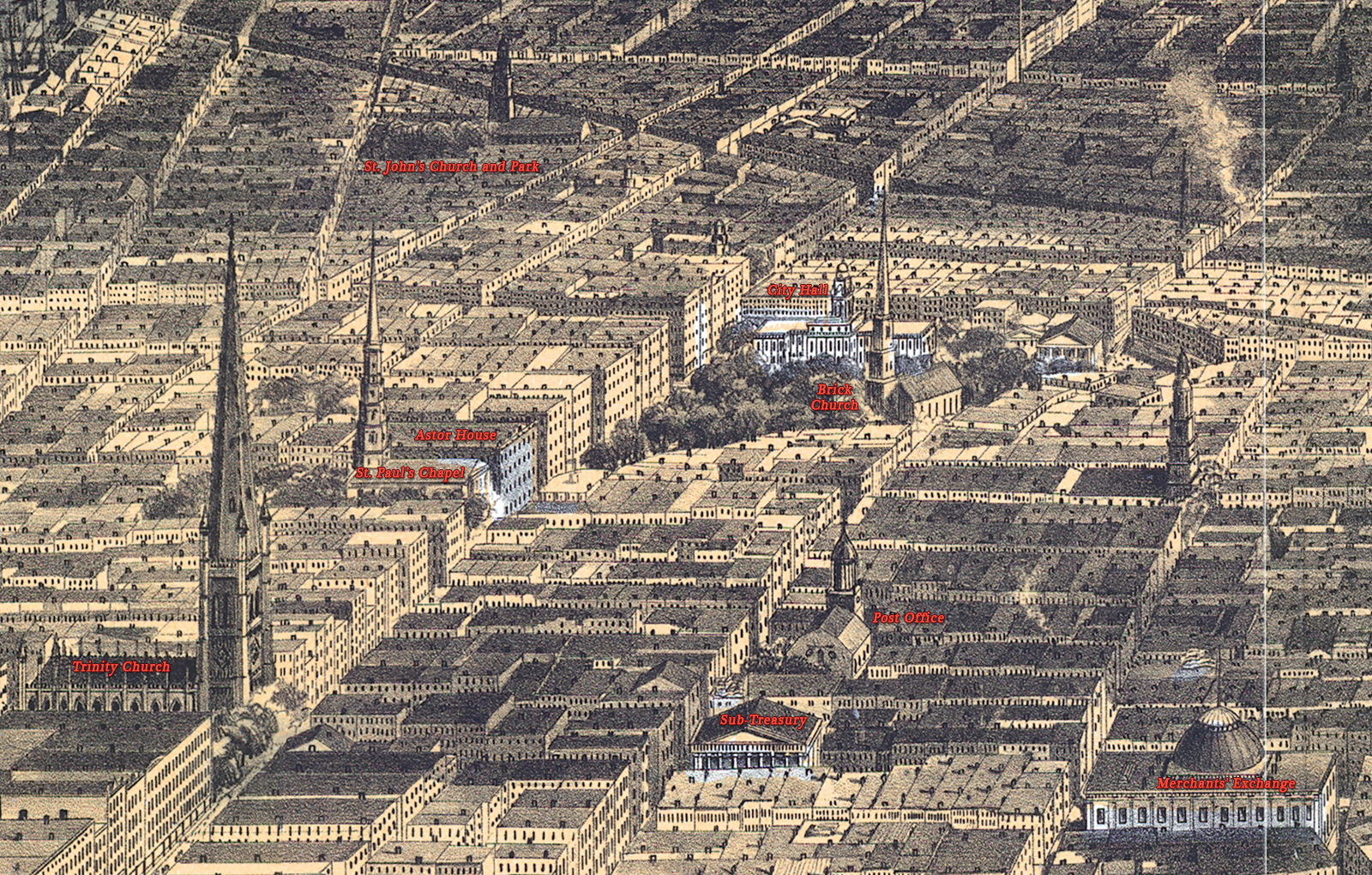


Enlargement of the center.
City of New York - Panoramic Illustration, 1856
Enlargement of a part of the port and South Street.
|
Copyright © Geographic Guide - 19th Century NYC. Historic Maps. |