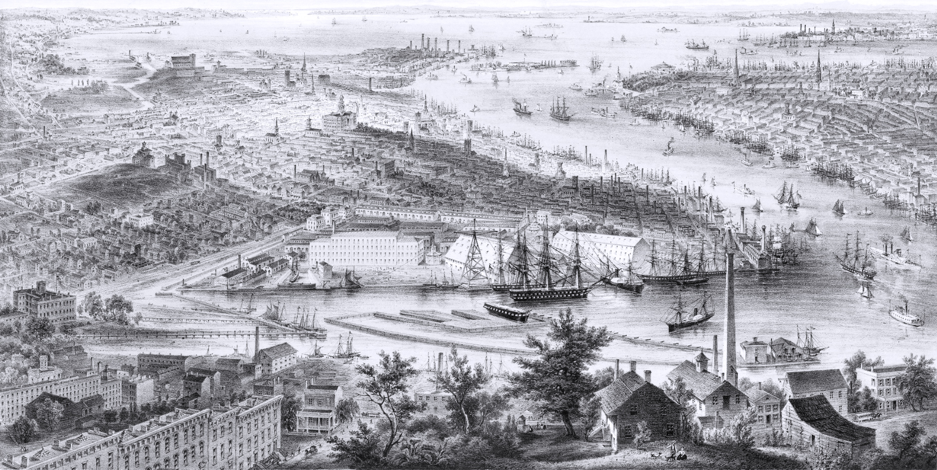
City of Brooklyn - 1855
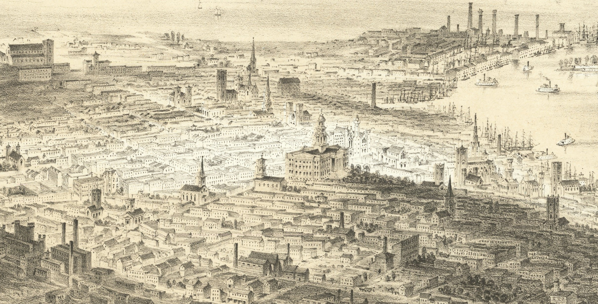
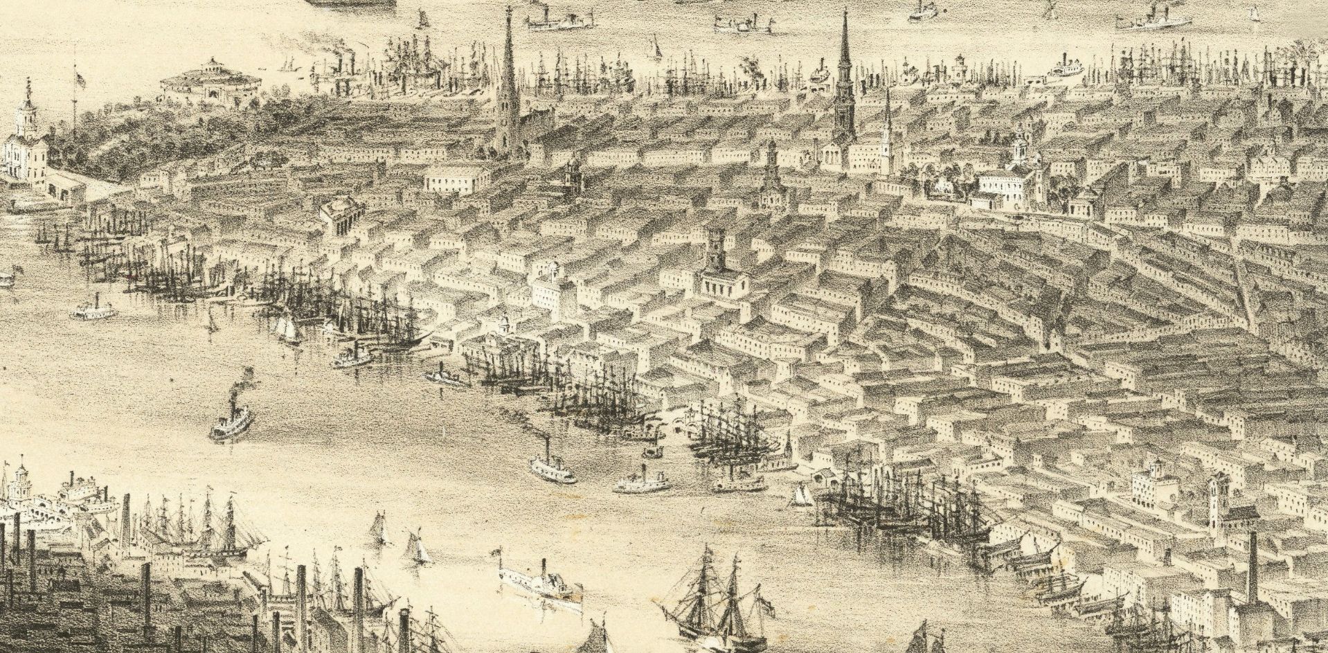
View of the City of Brooklyn, looking southeast over the Brooklyn Naval Yard, made by John Bornet and published in New York City in 1855. Bornet was both the original artist for the view and the lithographer. The engraving also shows Lower Manhattan, DUMBO, and Brooklyn Heights from Williamsburg. In the foreground is a scene of semi-rural life, indicating the kind of land and buildings that still existed in Brooklyn in the middle of the 19th century. Large warships are depicted in the Naval Yard along with famous buildings. Original title: City of Brooklyn, L. I. taken from Rush Street. Source: Barry Lawrence Ruderman Antique Maps. Below, enlargements of downtown Brooklyn and Lower Manhattan.
The name Brooklyn comes from the Dutch colonial name Breuckelen, meaning marshland, established in the 17th century. In 1898, Brooklyn joined New York and became part of the same metropolis, also including the Bronx, Queens and Staten Island.


|
Copyright © Geographic Guide - Antique images of NYC. |
City of Brooklyn - 1855