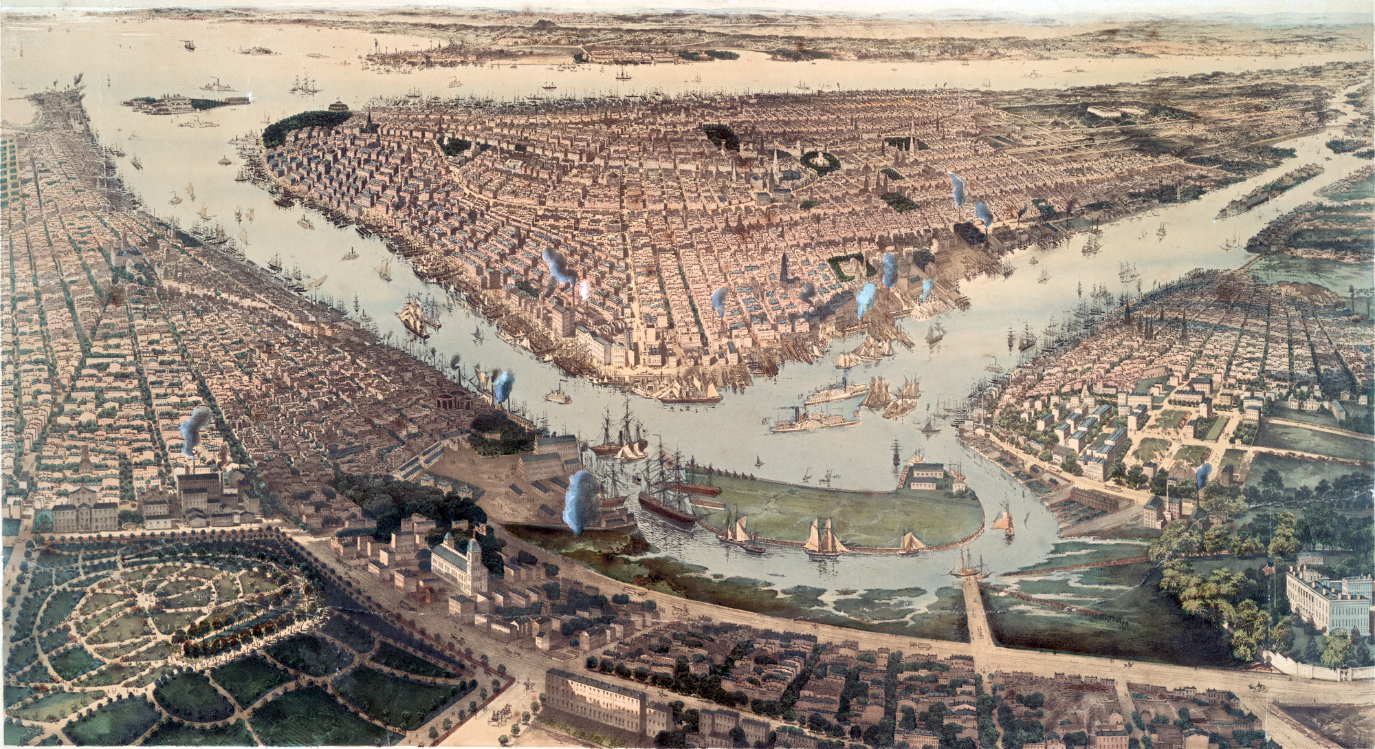
New York, Brooklyn, Williamsburg - 1859
Bird's eye view of the City of New York, Brooklyn. Williamsburg. In the foreground is the Navy Yard, in Brooklyn. Illustration by John Bachmann. Published by Charles Magnus & Co. 1859. Source: New York Public Library.
John Bachmann (1814–1896) was a German-speaking Swiss artist and lithographer. His first known print in the United States appeared in 1849, a view from an imagined point above Union Square in New York, looking south toward the Battery.
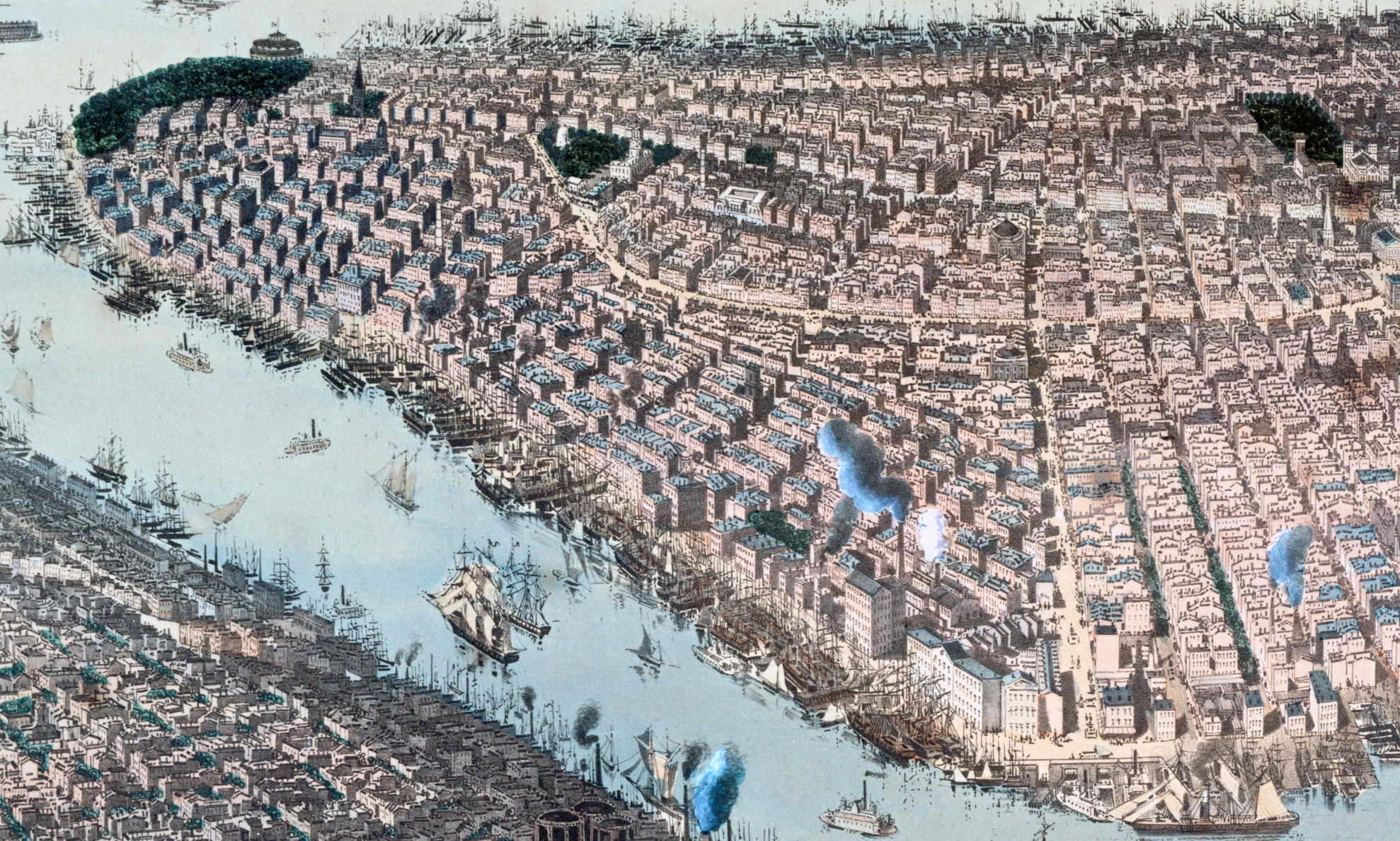
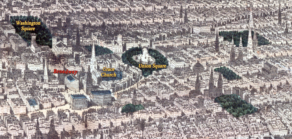
The consolidation of the Bronx, Brooklyn, Manhattan, Queens and Staten Island took effect in 1898, before that the cities of New York and Brooklyn were competing for commerce. The Washington Park, on the bottom left, was created in 1847 and renamed Fort Greene Park in 1897. Williamsburg and Blackwell's Island (now Roosevelt Island) are on the right. On the right, enlargement of the Union Square and environs. Below, enlargement of Lower Manhattan.
Washington Park, now Fort Greene Park
More: Historical maps of New York City ►

Madison Square

New York, Brooklyn, Williamsburg - 1859
|
Copyright © Geographic Guide - 19th Century NYC. Panoramic Views. |