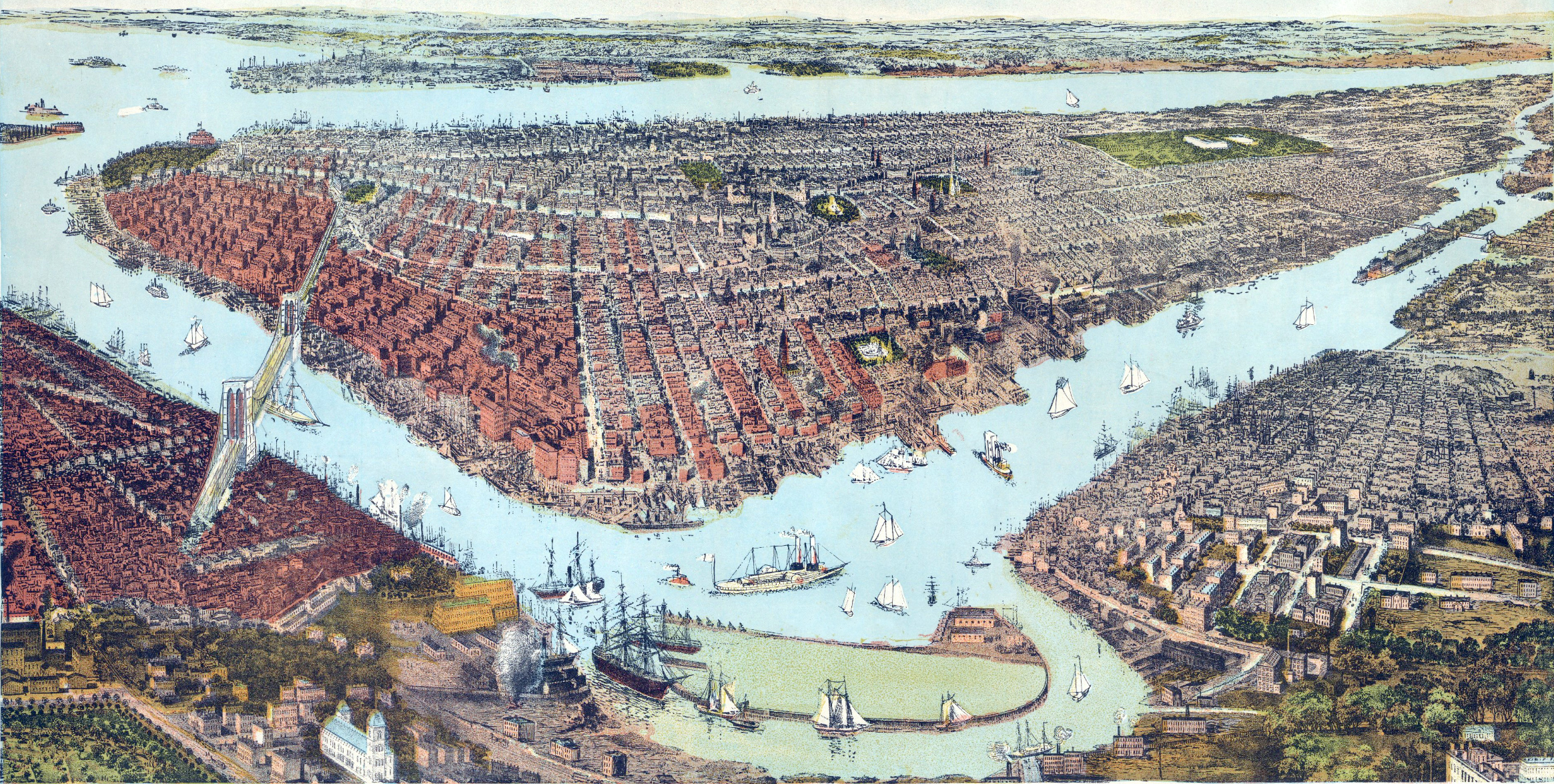
City of New York - 1877
Bird's-eye view of New York City from Fort Greene (on the bottom left), Brooklyn, looking west over the East River. This color-lithographed view was printed and published by Charles Magnus of New York. Text on print: Entered according to Act of Congress, in the year 1877, by Chas. Magnus, in the office of the Librarian of Congress at Washington. Source: Barry Lawrence Ruderman Antique Maps Inc.
The view is a lithographed reduction of John Bachmann's 1859 Bird's Eye View of the City of New York, with some updates. The Brooklyn Bridge was under construction at the time. It opened to traffic in 1883. The bridge to Queens (on the right), passing over the Blackwell's Island (now Roosevelt Island), was also planned. It opened to traffic in 1909, as the Queensboro Bridge.
Points of interest on print: "Fort Greene", "Castle Garden", "East River Bridge" (i.e., the Brooklyn Bridge, before completion), "Jersey City", "Hoboken", "Brooklyn Navy Yard", "Central Park", "Palisades", "Williamsburgh", "Long Island City", and "North, or Hudson River."


|
Copyright © Geographic Guide - 19th Century NYC Maps. |
City of New York - 1877