Skylines and Bird's Eye Views of New York City in 19th Century


More maps and panoramic views of NYC:

Maps of NYC - 17th Century

Maps of NYC - 18th Century

Maps of NYC - 19th Century

Maps of NYC - 20th Century

Bird's Eye Views of New York

Aerial Views of New York

Skylines of New York City


The New York City skyline changed dramatically in the 19th century. In the early years of the century, the tallest structures were church spires. The Gothic Trinity Church was the tallest structure in New York City from 1846, when it was dedicated, until 1888, when it was surpassed by the spires of St. Patrick's Cathedral. In 1890, the World Building became the first skyscraper to rise above the spires in the city. The century ended with the Park Row Building as the tallest structure in New York.


19th century maps of NYC


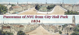
City Hall Park


New York City 19th Century


Bird's Eye View


NY globe


NY Nineteenth Century


Lower New York


Maps NYC


Central Park NY

View from Central Park looking south.


Old New York


Historical maps NYC


19th century NY


Nineteenth century NY


Southwest Prospect NY


East River NY


Skyline of the southern tip of Manhattan Island taken from Governors Island in 1816.


Panoramic View NY


Skyscrapers NY


New York Skyline images


Manhattan NYC


Manhattan NY


Manhattan 19th century

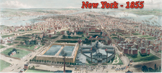
Lower Manhattan, looking south from 42nd Street, showing the Croton Reservoir and the Crystal Palace, built for the Exhibition of the Industries of All Nations, 1853/1854.


Nineteenth Century NY


Aerial views New York


Old NYC


NY skyline 19th century


Hudson River NY


Broadway NY 19th century


City Brooklyn


Waterfront NY


New York NY 19th century


Lower Manhattan


NYC nineteen century


Moses King NYC


NYC Fifth Avenue


New York City NY


East River waterfront


Brooklyn Heights


Central Park NY 1859


Panorama New York NY


New York nineteenth century


Brooklyn city


NY Panorama


East River NYC


Panorama New York City


Bird's Eye View of New York


Tip Manhattan


New York Governors Island


New York Illustration


New York City Brooklyn


NYC 19th century


NY Brooklyn old


North River NY


Projected bridge NY


Central Park 19th century


City New York panorama


New York City


New York NY


Manhattan Panorama


Broadway NY


City New York


Southern Manhattan


New York City 19th century


Manhattan


New York NY


Skylines and Bird's Eye Views of New York City in 19th Century


New-York & Brooklyn


Copyright © Geographic Guide - Historical Maps and Panoramas of NYC.


New York 1900


Historical maps NY