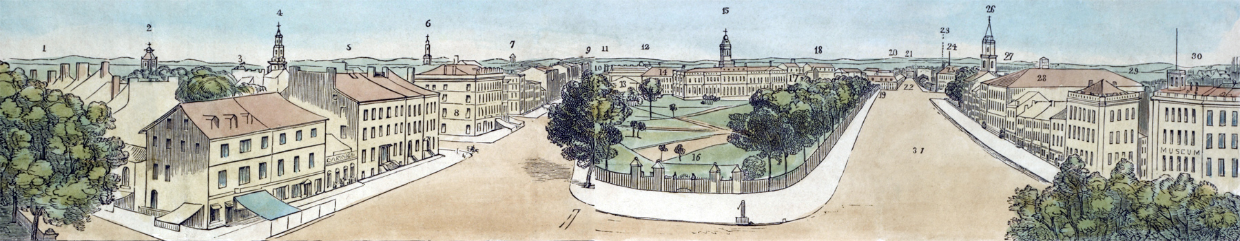
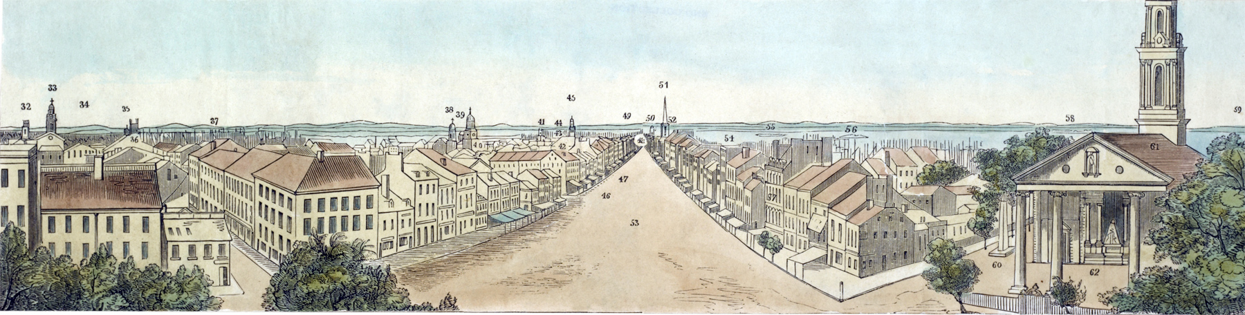
Panorama of New York from City Hall Park - 1834
Panorama of New York City in two plates with views of Chatham Street and Broadway, with the Hudson and East Rivers in the background of the first (top) block, as well as the bay with "Bedlow's Island" [i.e., Bedloe's Island, later Liberty Island] and Ellis Island in the background of the second (bottom) block.
Original title: A description of a view of New York, now exhibiting at the Panorama, Leicester Square. Source: New York Public Library.
Note: "R. Burford's Panorama" was, in fact, a place in Leicester Square, London. The year 1834 is based on a black & white version by Robert Burford (1791-1861), printed by T. Brettell, Rupert Street, Haymarket. Source: Library of Congress, popular graphic art print filing series.
5 - Old State Prison. 6 - St. John's Church. 7 - Hospital. 8 - American Hotel. 9 - St. Thomas Church. 10 - Masonic Hall. 11 - Reservoir. 12 - St. Patrick's Cathedral. 13 - Bridewell.
14 - New York Institution. 15 - City Hall. 16 - Park. 17 - Rotunda. 18 - Bowery Theater. 19 - Public School. 20 - Athenaeum. 21 - Baptist Church. 22 - Chatham Square. 23 - Quaker's Meeting.
24 - Mariner's Church. 25 - Tammany Hall. 26 - Presbyterian Church [Brick Church]. 27 - Williamsburgh. 28 - Park Theater. 29 - Wallabought Bay. 30 - Navy Yard [Brooklyn]. 31 - Chatham Street.
1 - Hudson River. 2 - St. Peter's Church. 3 - Columbia College. 4 - Central Presbyterian Church.
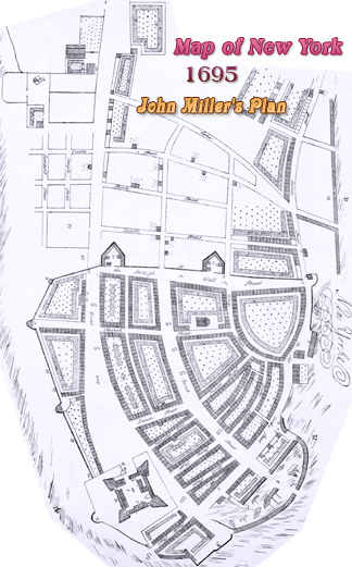
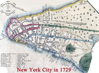
More: Historical maps of New York City ►
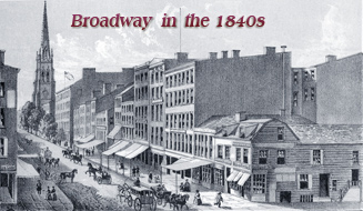
Broadway
32 - St. George's Church. 33 - North Dutch Church. 34 - Brooklyn. 35 - Holt's Hotel.
36 - Baptist Church. 37 - East River. 38 - Presbyterian Church. 39 - Exchange.
40 - Dutch Reformed Church. 41 - Ditto. 42 - Custom House. 43 - Governor's Island.
44 - Narrows. 45 - Presbyterian Church. 46 - Webb's Hotel. 47 - National Hotel.
48 - Adelphi Hotel. 49 - Staten Island. 50 - Grace Church. 51 - Trinity Church.
52 - City Hotel. 53 - Broadway. 54 - Bay. 55 - Bedlow's Island. 56 - Ellis's Island.
57 - Franklin Hall. 58 - Jersey City. 59 - Hoboken. 60 - Emmett's Monument.
61 - St. Paul's. 62 - General Montgomery's Monument.
American Hotel
View looking north from City Hall Park.
Chatham Street, later Park Row
◄ Barclay St.
Vesey St.
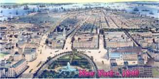
Panorama of New York from City Hall Park - 1834

|
Copyright © Geographic Guide - 19th Century NYC. |
View looking south from City Hall Park.
Broadway