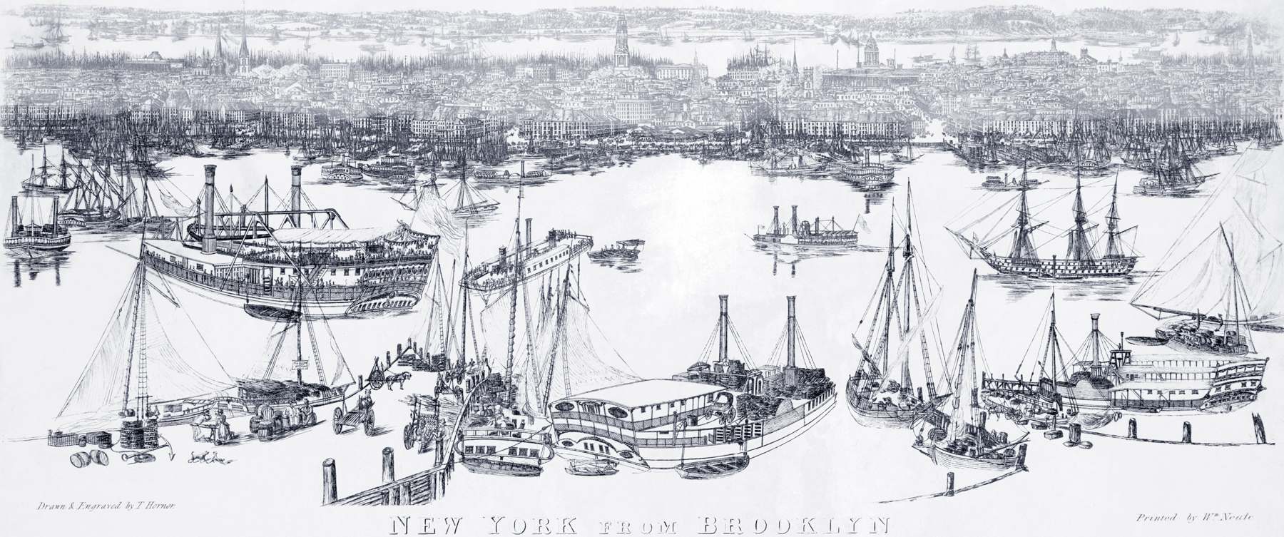
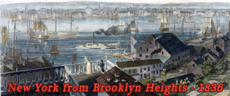
New York City, East River from Brooklyn - about 1840
View of Lower Manhattan from Brooklyn, about 1840. Illustration created and engraved by Thomas Hornor (1785-1844). Printed by Wm. Neale. Source: New York Public Library. Waterfront of East River with crowded harbors. East River had become a great thoroughfare on water, thronged with vessels of every class, including steamboats.
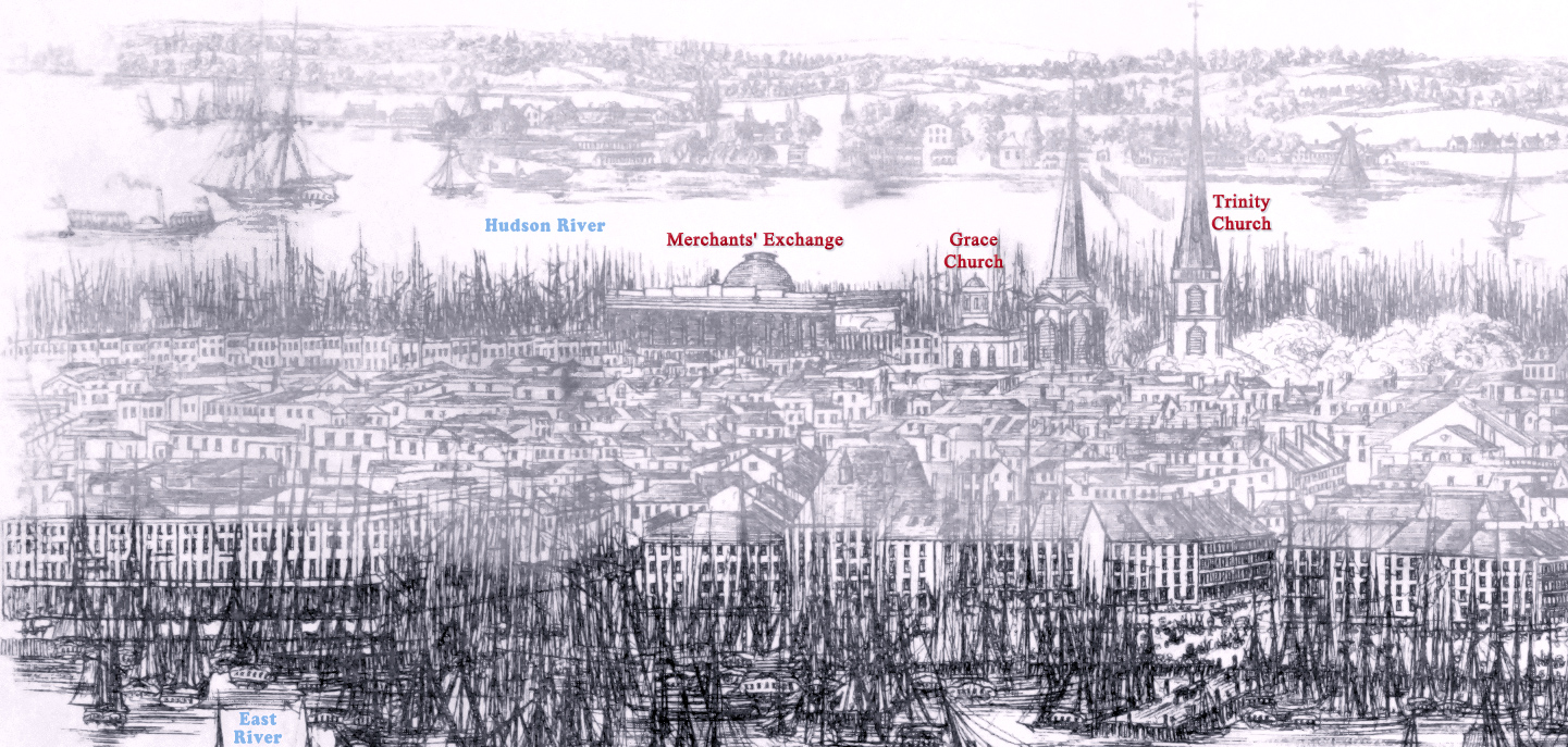
This drawing shows two buildings that did not fully existed at the same time: the second temple of Trinity Church, demolished by September, 1839, and the second Merchants' Exchange building (55 Wall Street), that was opened in 1841. The first Merchants' Exchange building was destroyed in the Great Fire of 1835.
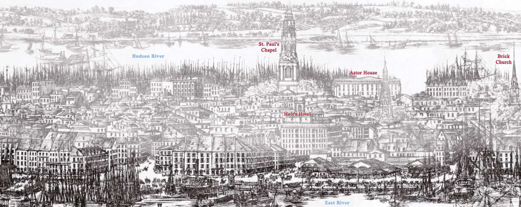
Below, this illustration is enlarged in pieces.
|
Copyright © Geographic Guide - Waterfront 19th Century NYC. |
More: Historical maps of New York City ►
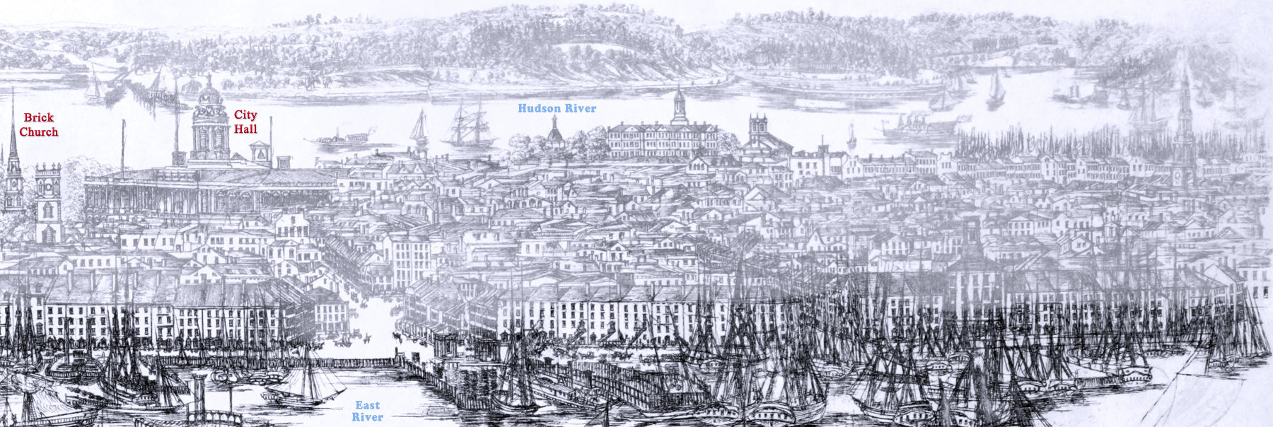
Enlargement of the first part of the drawing above.
North Dutch Church, Fulton and William streets.


New York City, East River from Brooklyn - about 1840